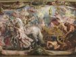
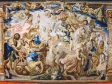
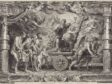
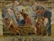
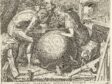
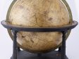
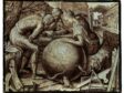
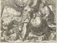
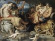
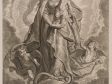
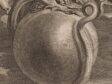
Rubens routinely, and quite literally, emptied the globe. In his paintings, Rubens rendered the earth a blanked orb—scumbles of lines, blue-green washes, ill-defined blobs. This essay takes such pictorial inattentiveness as a starting point for highlighting artists and paintings that, instead, carefully depicted the globe to put geographic knowledge on view. Frans Floris, Maerten de Vos, Frans Francken II, and colonial Latin American artists working after Rubens—among others—visualized specific geographies to engage emergent geopolitical realities. The pictured globe thereby prompts methodological considerations for a globalizing art history.
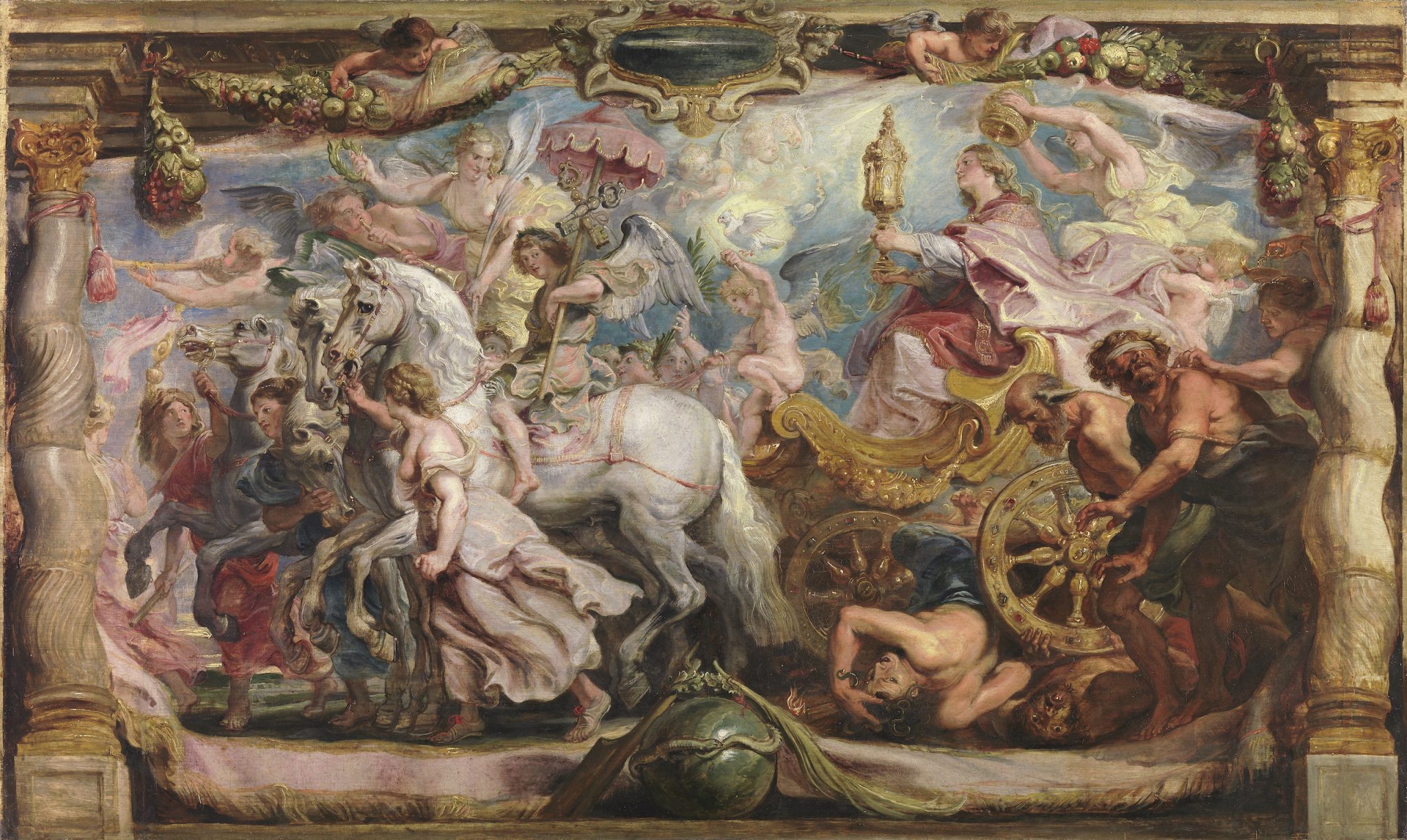
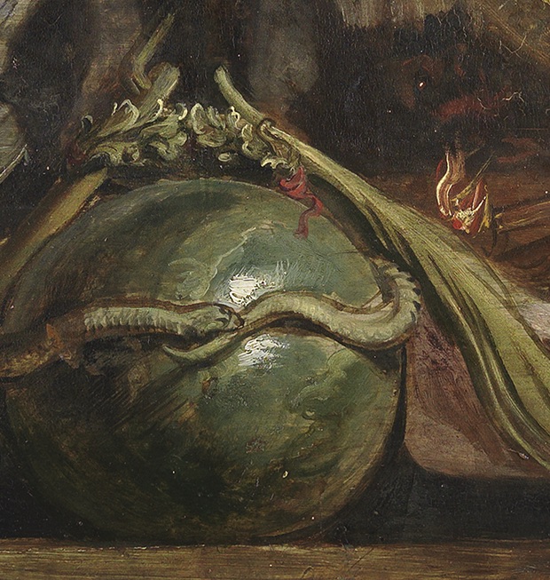
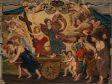
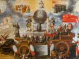
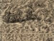
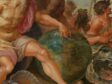
When around 1625 Peter Paul Rubens (1577–1640) finished his oil sketch Triumph of the Church Through the Eucharist, he had created, by any measure, a busy and particularly detailed scene (fig. 1). However gestural its overall mode of paint application, the oil sketch includes even the description of individual feathers on the dove of the Holy Spirit and the suggestion of a cross stamped into the eucharistic wafer in the monstrance held out by the female figure representing the Catholic Church. Other moments of particularized visual attention abound throughout the sketch. Against this backdrop, the globe that features so prominently at the forefront of the composition—wrapped by a snake devouring its own tail to symbolize eternity—is an exception (fig. 2). The orb is a blur of blues and greens. Indeed, little aside from these colors tells us that it is meant to be a globe at all. There are no land masses and no defined coastlines—no boot of Italy, no Gulf of Mexico. So accustomed are we to seeing the globe that we find it easy to fill in the visual gaps—to conjure an entire world from a muddled surface.1 And yet, it is notable that Rubens lavished more visual attention on almost every other aspect of this allegory than the one that finds itself front and center.
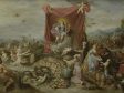
This oil sketch was not, of course, a final product. Rubens was merely making an initial design that would be elaborated as a workshop cartoon, then as a series of tapestries, and eventually as prints. But the results of these elaborations are equally perplexing. The tapestry weavers in Brussels who rendered the design anew in thread took up the geographic potential of Rubens’s design, but they had been offered little guidance, and the globe they produced is even further estranging (fig. 3).2 What geography are we looking at? An oblong landmass dominates the space, but it acts as a large island among other islands, with none of the four continents known in the seventeenth century coming into view. Green blobs bob in a vast blue sea.

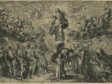
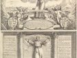
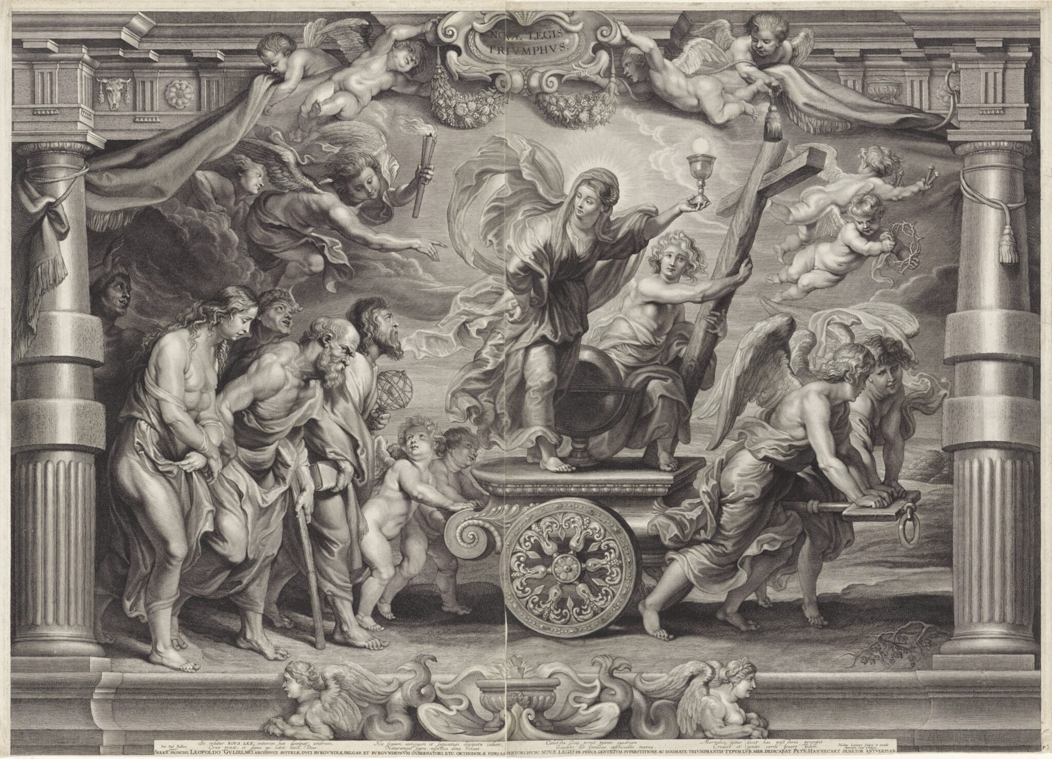
On the other hand, printers Schelte à Bolswert (ca. 1586–1659) and Nicolas Lauwers (1600–1652), when they brought this design to market after Rubens’s lifetime, took his sparse visual cues in the opposite direction (fig. 4). Where Rubens’s color palette had at least offered the suggestion of land and sea, the engraving’s cross-hatching and swelling curves cancel this content and leave in its place a generic symbol. To be fair, there was good enough reason for this choice. What might seem confusion or imprecision stems from the fact that this orb was not really intended to represent the “globe,” per se. In an allegory about the church’s triumph, the sphere stands as a generic, universalizing orbus mundi, one that does not require—or may even recommend against—geographic specificity.
Other compositions in Rubens’s same series, however, cannot be explained away so easily. In The Triumph of the Faith, the orb is specified via its mount, a globe stand (fig. 5). In the entourage that trails behind the cart and approaches the true faith, a man carries an armillary sphere, thus leaving little ambiguity about either the globe’s identity or its message. Together these two tools—mounted globe and armillary sphere—allow the worldly and the heavenly realms, respectively, to be seen and understood.3 Faith will be victorious in both.
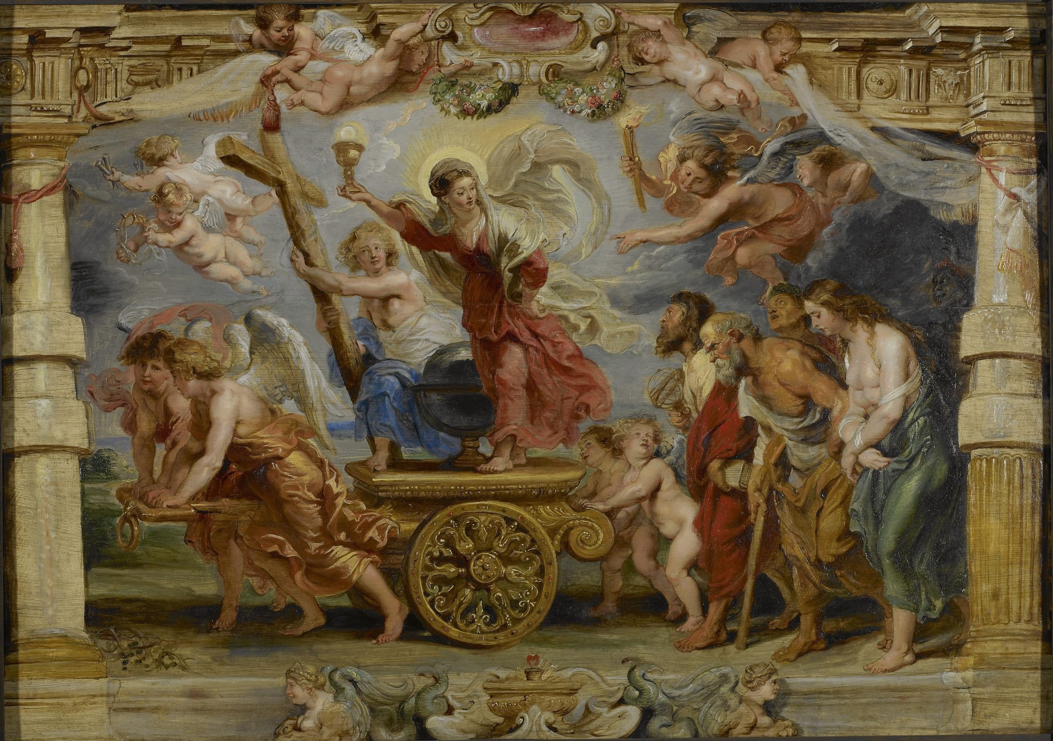
Yet Rubens’s design is, in this case, even more firmly un-geographic—one might even say anti-geographic. Using gray-blue, he slicked the orb uniformly. The missing continents cannot be chalked up to visual shorthand, to an economical use of paint and attention, for when he and his workshop elaborated this composition in a larger patroon for tapestry weavers, no extra attention was paid to the globe.4 It was, once again, made to be insistently blank, leaving the weavers to guess at and approximate geographic forms.
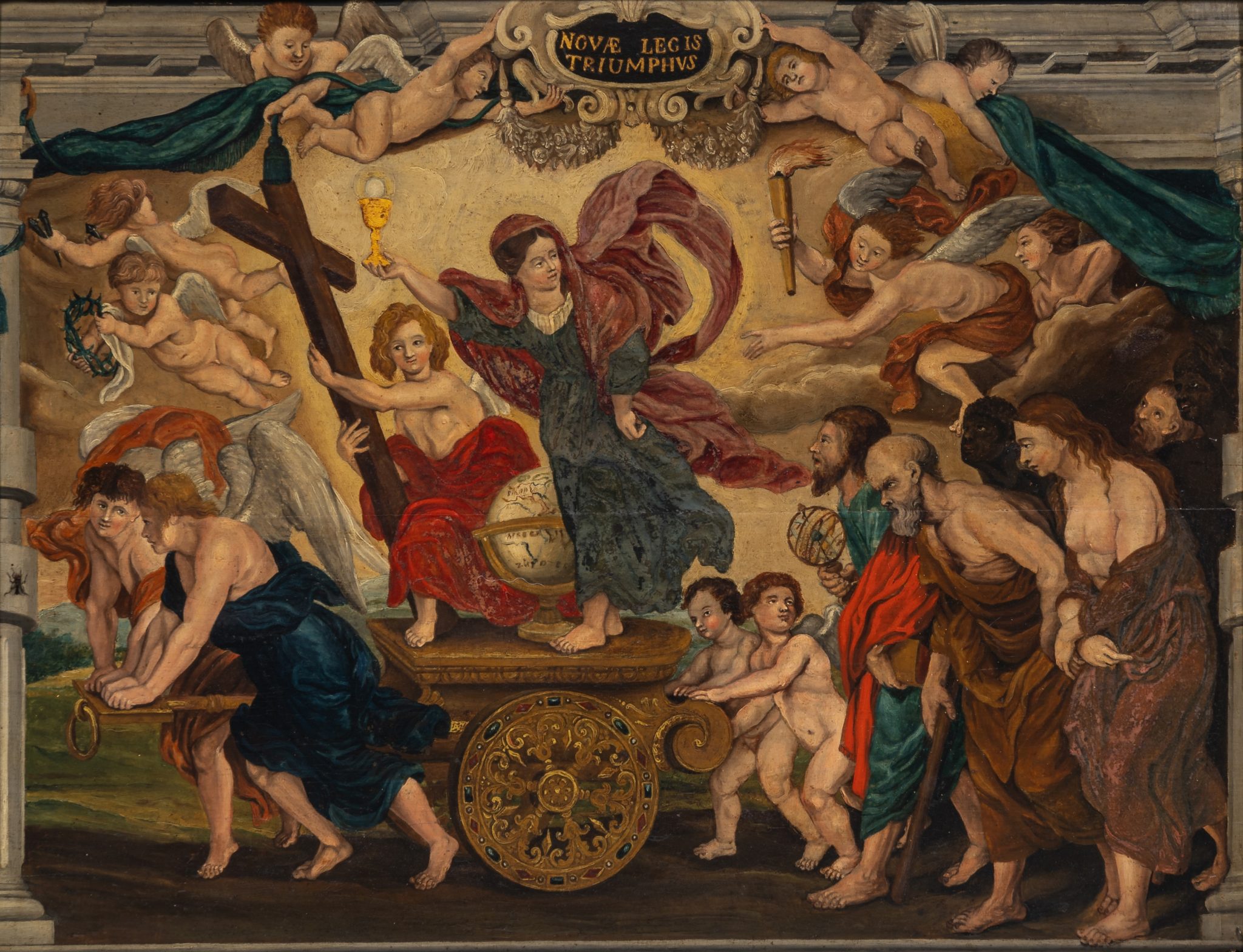
In a painterly project otherwise dedicated to taking seemingly every opportunity to put erudition and precision on display, Rubens not infrequently emptied the world. This essay draws out such seeming indifference to the globe’s surfaces. It does so, however, not as an end unto itself but as a starting point for thinking through alternative approaches. One could compare Rubens’s original composition of The Triumph of the Faith, for instance, with an anonymous and unstudied Flemish copy made following the printed version of Rubens’s design, as the cartouche inscription at top—NOVAE LEGIS TRIUMPHVS—confirms (fig. 6). Although nothing suggests that the artist was interested in (or capable of) capturing the original effects of Rubens’s painted flesh and drapery, the copy nonetheless acts as a notable counterpoint. Any copy might underscore, shift, or reinterpret an aspect of an original.5 In this case, the artist directed attention to the globe that Rubens had left undeveloped, going to the effort of visualizing and filling in the distinct contours of the known world, separating landmasses via colors, and even labeling the continents of Europe and Africa (along with the South Sea). This copy—perhaps not captivating in a traditional artistic sense, and with no documented context of production—already goes some way to historicize the idea that Rubens’s emptied spheres should cause us to raise an eyebrow.6 It begins to point toward historical actors who, for their parts, also found Rubens’s globes odd, his globality wanting. This essay suggests that there may be interpretive gains to be had in following their lead.
To do so, I focus on the literal figure of the globe, which has ironically not been a site of sustained attention within a globalizing art history.7 This will push toward what I here term Rubens’s “global inattentiveness,” a disinclination toward thinking about the globe as both an object and a rapidly changing concept during the early modern period. Recognizing such a stance helps to focalize, by contrast, the profound interest that other artists took in the subject—how carefully they handled the globe and how it became an interpretive key to their pictures in ways that have eluded art historians.
Each of the following sections draws out a specific aspect of northern artists’ treatments of the globe and offers a critical term with which to describe their pictorial operations. The first section will show how artists interpolated or projected the globe into the blanks that Rubens had left them; the second illustrates just how particularized the view of a globe could be within the pictorial field (both in terms of specific geographic reference points and as an object with a history in its own right); and the third stresses how artists could position the globe, spinning and framing the terrestrial orb to reveal and highlight certain geographic views. Via all three operations, artists keyed attention to geography in order to articulate urgent, contemporary political meanings for their viewers. Paying close attention to globes in paintings reveals that they were a space in which artists were quick to reflect geopolitical developments.8
To close, this essay considers the methodological challenges (but also promises) of coming to terms with just how out of step Rubens was with other early modern artists—ones that came before him, worked alongside him, and made copies after his models. I offer potential reasons for why Rubens might have resisted the shifting global shapes and accompanying discourses of his own time. Doing so allows for an articulation of some of the pressing considerations that art history—both centered on northern Europe and more broadly—now faces, decades into the discipline’s global turn.
Interpolation
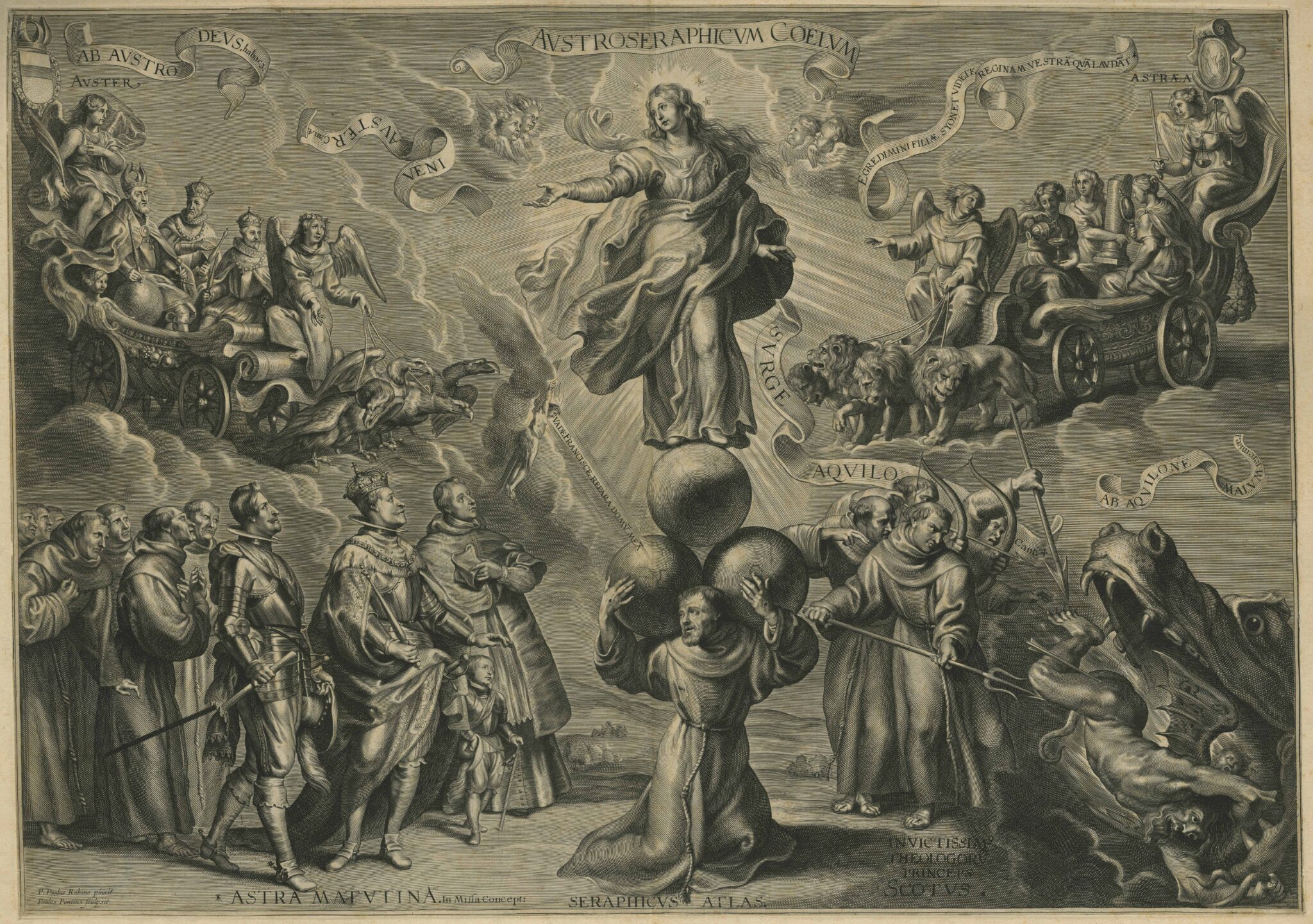
We find not one but three of Rubens’s empty orbs atop St. Francis’s shoulders at the center of a complicated allegory that likely was meant to act as the model for the top portion of a thesis print (fig. 7).9 Francis kneels, supporting these orbs as a pedestal for the Virgin of the Immaculate Conception. These spheres are even more insistently blank than those we have seen up to this point—mirrored surfaces across which Rubens applied a harsh white light in a preparatory oil sketch, one executed in grayscale to serve specifically as the basis for the print, completed by Paulus Pontius (1603–1658).10 Francis evokes the mythological figure of Atlas holding up the heavens in a composition that amounts to a joint defense of the Immaculate Conception by the Franciscan Order and the house of Habsburg. On the left, staring up at the Virgin in devotion, stand the Habsburg rulers at the time of the engraving’s design, with their deceased predecessors looking on from a heavenly chariot. On the right, a group of Franciscans drives a devilish figure into the jaws of hell. Thin printed lines run through the graduated tones of the orbs’ surfaces. Appearing like blurred formations, they lure the viewer’s eye to identify shapes that refuse to resolve into anything more than ink and paper.
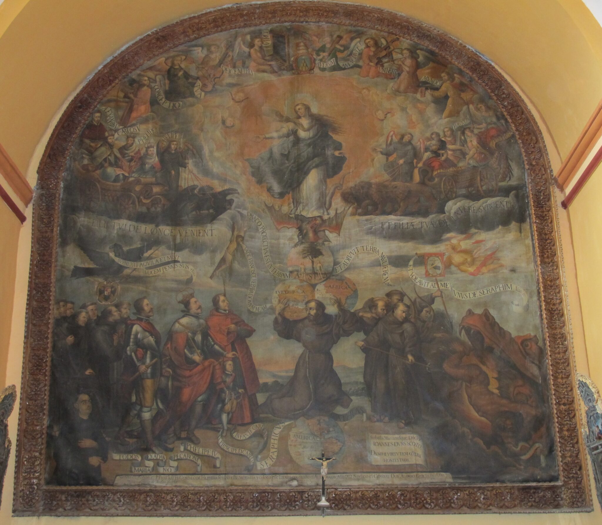
In an allegory of this complexity, and with three orbs instead of one, there is no reason to presume that these would or should represent globes. And yet an ocean away, in Ayacucho, Peru, a painter took the blankness of Rubens’s spheres as a geographical prompt (fig. 8). The painting, by Fabian Pérez Medina (dates unknown), is faithful to the printed source. This was perhaps a stipulation of the patron pictured at lower left, Don Alonso García de Araujo.11 Indeed, in Latin America, patrons not infrequently supplied a painter with a print as a model to which the completed painting was to conform. At the same time, the three blank orbs have been rendered as globes, spun to reveal views of Asia, Africa, and Europe; Francis now balances on a fourth globe, labeled America, rooting the saint into the very continent on which his printed figure had come to be rendered in paint. The topmost orb does not reveal a landmass; instead it contains the Garden of Eden, reflecting debates about the Garden’s location—here posited as Asia.12
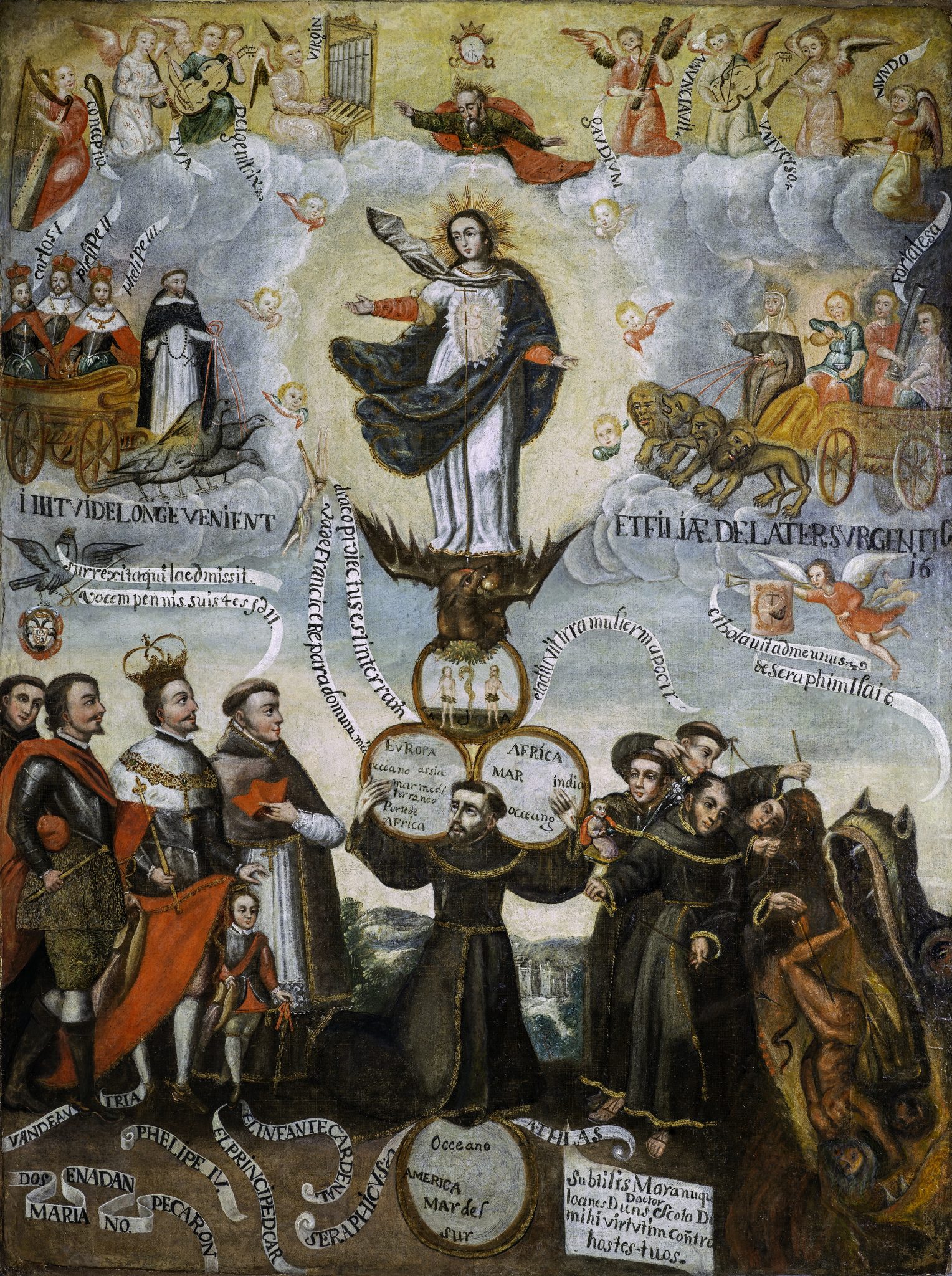
This was not a one-off way to interpret Rubens’s orbs, a fact that reveals both the sense of incompleteness that the orbs elicited and the degree to which geographic thinking came naturally to Andean artists working with this composition. At least four canvases produced in the colonial Andes resulted from exactly the same impulse—to interpolate into these spheres the continental masses that occupied so much attention, the world over.13 Most of the surviving copies or derivations of Rubens’s print in Latin America were meant for the private spaces of Franciscan convents or semi-restricted parts of churches (sacristies, laterals alongside high altars). One should therefore not understand these changes as stemming from a desire for missionary tools with unambiguous visual messages for didactic functions. Rather, these pictorial responses to Rubens resulted from, within, and for a viewership of Franciscans wishing to think about and to shift elements of the original composition.
Indeed, in a recently discovered example, a now-anonymous painter’s interpolation for such a community functions in a yet more complicated fashion (fig. 9). There are no depicted landmasses to be seen, but labels appended to the orbs anchor the continents at their relative points. The beholder can thus find, in textual form, Europe, Asia, Africa, America, and the oceans and seas that separate them. The corresponding landmasses may also once have been pictured; the white grounds we now find are perhaps the result of a later restoration.14 In either case, the picture now works to reconcile the blankness of the printed model with the impulse to see particular geographies in the orbs. The labels provide the rough guidelines, the coordinate points on the earth’s surface, but the painting ultimately now leaves it to the viewer to imagine and project these spaces of the world into pure white blanks.
Period viewers in the Andes, well beyond the Franciscans, would have been perfectly capable of doing so. In a locale that most Europeans would have considered remote, maps and mapping captured attention. For instance, in Diego Dávalos y Figueroa’s Miscelánea austral, published in Lima in 1602, two main characters engage in conversation as they meander through La Paz (in present-day Bolivia). Turning to issues of printing, Delio notes a preference for Venetian cartographers and prints, suggesting that they should not be held in “lower estimation” than the most influential atlases published in Antwerp, particularly Abraham Ortelius’s 1570 Theatrum orbis terrarum.15 Cilena then queries, “And why do they give [Ortelius’s atlas] this name?” Delio responds, “Because it represents all the cities (or more!) of the universe . . . and with such perfection and propriety that anyone who knows one of them seeks out seeing it in the print and rejoices.” All the cities of the universe are imagined from a point so high up in the mountains that the air is thin, and trees struggle to grow. The characters of this Peruvian dialogue underscore just how deeply certain segments of the colonial population cared about the geographic knowledge circulating through imperial networks.
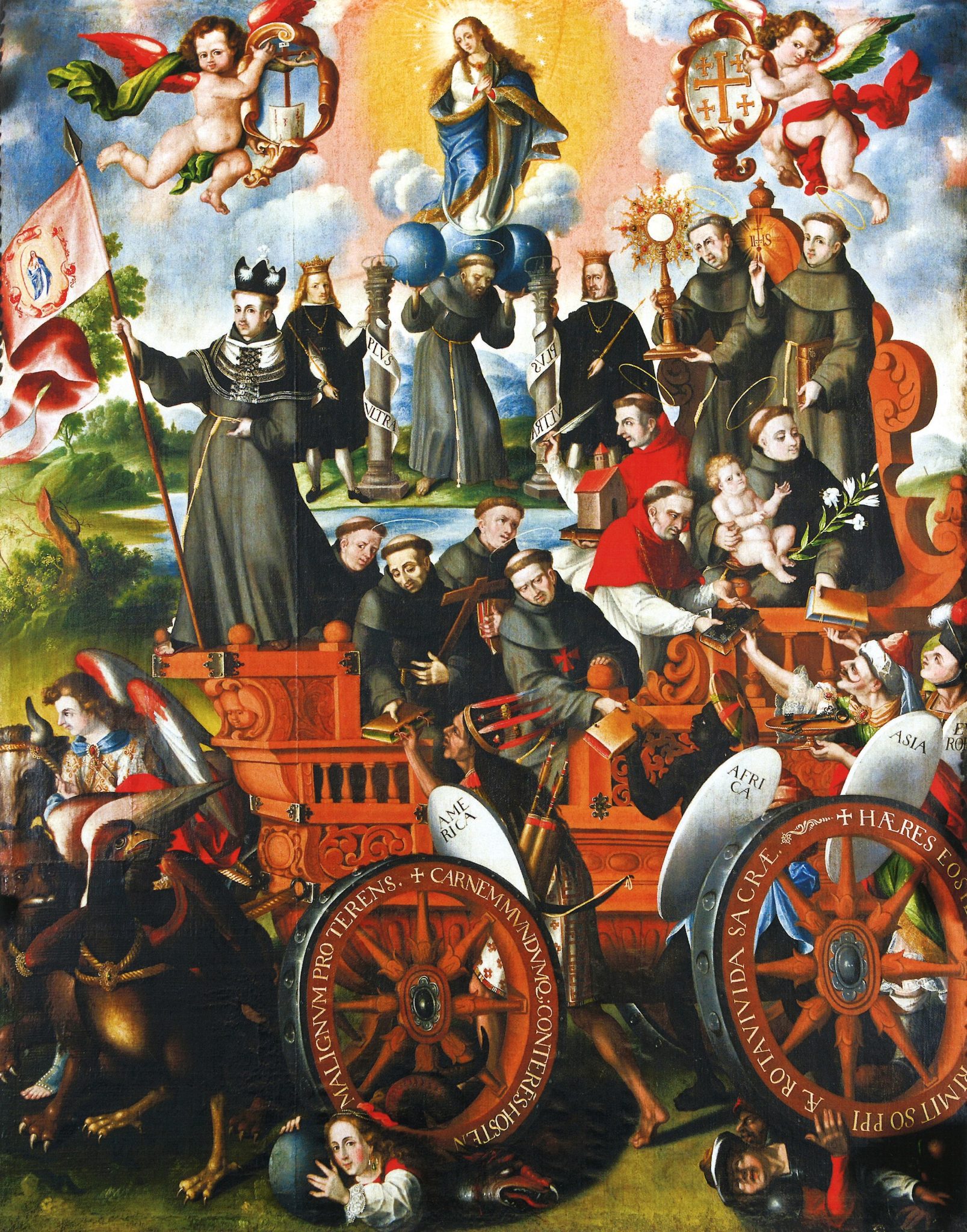
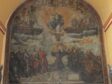
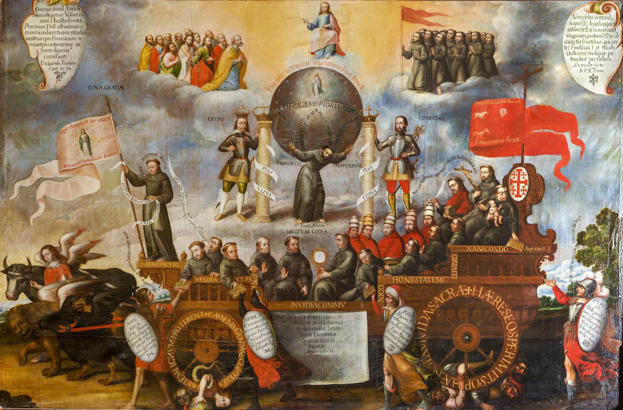
Utilizing such specific place names and worldly distributions was not, however, the only way that Andean audiences geographically reimagined Rubens’s orbs. In a series of elaborations housed in churches in the highlands of present-day Bolivia, the allegory of Rubens’s print was copied, unfurled, and supplemented.16 In a vertically formatted canvas in the cathedral of La Paz, for instance, one finds Rubens’s kneeling Francis now standing in a dense, compressed allegory (fig. 10). His orbs remain blank, but their geographic prompt has been projected into allegorical figures of the continents who clamor after the triumphal cart and receive the word of God from the Franciscans. A feathered personification of America takes pride of place. Rubens’s Atlas/Francis, balancing between the Pillars of Hercules, cues attention to this geographic mode. The pillars, bedecked with the mirrored Habsburg motto “Plus Ultra,” serve as an exhortation to geographically extend empire and missionary work “further beyond.”
About twenty-five years later, this picture was copied for the Franciscan church of Cochabamba, Bolivia, its elements stretched across a horizontal format (fig. 11). Again, all four continents run along with the chariot. But some important changes were made. The three orbs of Rubens’s Francis have been traded for a lone sphere, and that orb now represents a specific geography labeled as “AMERICA MERIDIONALIS” (South America). This particularization of geographic location reflects another shift: the figure who here holds the globe is no longer St. Francis of Assisi but rather Saint Francis Solano (1549–1610), identified by the label below his feet. Solano was a missionary in South America, where he spent his life Christianizing Indigenous populations.
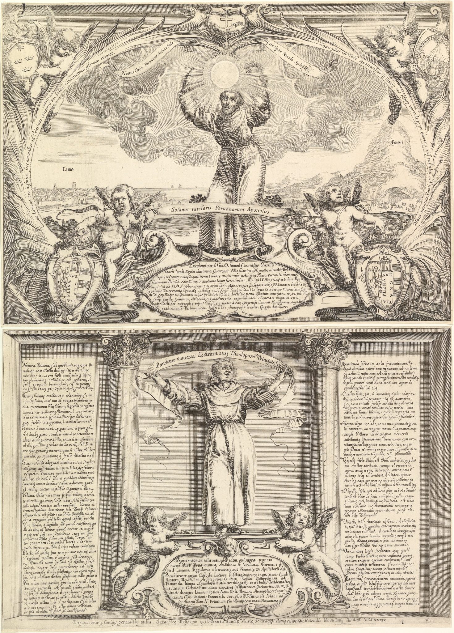
The idea to swap Francises—Solano for Assisi—came from another print derived from Rubens’s initial engraving (fig. 12). Working in Rome in 1639, less than a decade after Rubens devised the composition, the printmaker Stefano della Bella (1610–1664) made Rubens’s Atlas/Francis figure stand, although an appended banderole that cuts across the figure’s knees still evokes his previously kneeling crouch.17 As it would later be in the Bolivian painting, the standing figure is Francis Solano. Notably, the saint holds no orbs at all but instead reaches with the same widespread arms to embrace, like a monstrance holding the Eucharist, the sun itself, underscoring the figure’s name (Sol-ano). The Roman print does not, however, forego the geographic associations of Rubens’s globe-like orbs. Behind Solano, a landscape stretches across the composition, identifiable by the inscriptions and the representation as the Viceroyalty of Peru, reaching from Lima on the coast to Mount Potosí in the highlands.
The painter in Cochabamba seems to have combined the iconography of Rubens’s engraving with that of the Roman print, itself also inspired by Rubens’s design. This artist took as the basis for his picture the earlier canvas in La Paz that had similarly used Rubens’s engraving as its point of departure, but he replaced the kneeling St. Francis of Assisi with the standing figure of St. Francis Solano from the Roman print. His stance and posture are copied exactly (simply in reverse orientation), along with the positioning of his wide-set hands. Using Rubens’s idea of the globe, the artist compressed the expansive geography of “South America” (AMERICA MERIDIONALIS) from the background of the Roman print and placed it atop this figure’s shoulders. That is, the Cochabamba painting coordinates local responses to Rubens’s engraving with another pictorial response to Rubens—the print by Stefano della Bella—that had originated across the Atlantic, in Rome.
The Roman print had a second tie to the Americas. If the first referent was its subject—Francis Solano, who had left Europe to perform missionary work in South America—the second was its dedicatee, a man who had just arrived in Europe from that same geographical region, the Franciscan friar Buenaventura de Salinas y Córdoba (1592–1653). The print was also a thesis sheet, created for a doctoral thesis defense at the Roman convent of Santa Maria in Aracoeli in 1639. Such a defense was the capstone of early modern education, and these events used printed sheets to direct the discussion with written postulates along with an accompanying image that could reinforce or complicate such themes.18 Thesis defenses and, in turn, their accompanying prints, were often dedicated to a particular person, in this case Salinas y Córdoba. He had recently arrived in Rome from Peru—having been born, raised, and theologically trained in Lima—and had published a treatise about Franciscan missionization in South America in which he ardently advocated for the promotion of Francis Solano to sainthood.19
The efforts of these two men—Solano and Salinas y Córdoba—in Latin America reflect the larger Franciscan order’s geographical orientation, the focus of its efforts in spreading the word of God to the far edges of the globe. In terms of the pictures, it is notable that the Roman printmaker saw in Rubens’s engraving the potential for a particular geographical reflection.20 Perhaps yet more so that the painter in Bolivia, heir to the Roman print and the print of Rubens, would connect the two and project this Latin American landscape and its geographic specificity back into the globes on Francis’s shoulders. In examining the Roman print and the Bolivian painting, we see the earth’s geographies—along with ideas about two individual Franciscans—transiting the actual globe, crisscrossing the Atlantic. The artists who made these pictures put that geographic specification to work via orbs that Rubens himself had left obdurately blank—despite a composition that almost begged for further inflection of its geopolitical allegory.
Particularization
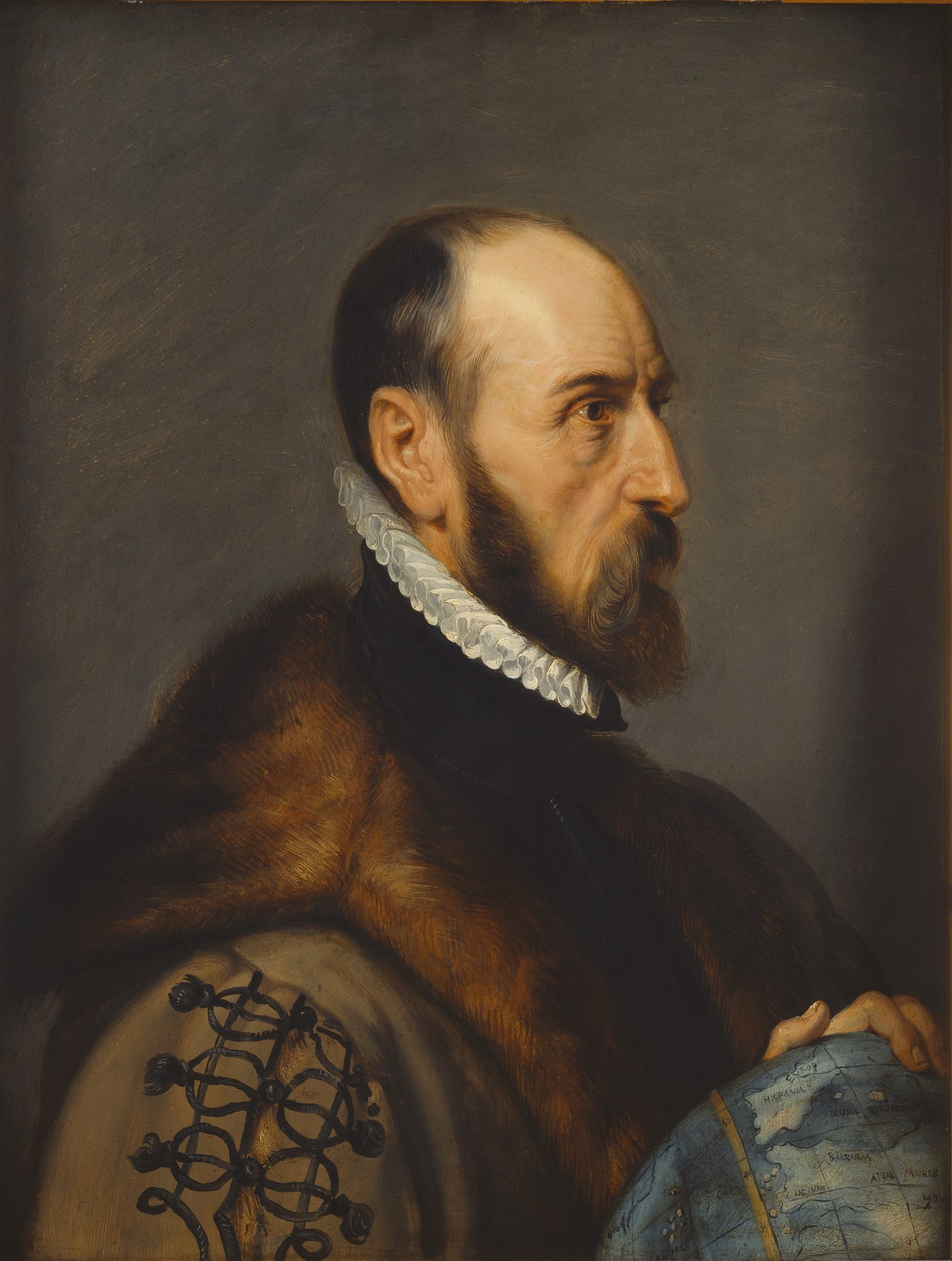
Claiming anything “in the negative”—in this case, to say that Rubens was disinclined toward rather than highly invested in the globe—naturally invites consideration of exceptions. Here I offer and contextualize several in order to make certain qualifications about how one might understand Rubens’s global investments or disinclinations. His (and his studio’s) posthumous portrait of Abraham Ortelius (1527–1598) from the early 1630s, for instance, clearly includes a globe, and, even without the help of the added labels, we can identify the edge of Europe, the Iberian Peninsula, a bit of the Mediterranean, and the northern reaches of Africa (fig. 13).21 We can infer, in turn, that Ortelius holds this sphere at roughly the point of the Southern Netherlands, providing the origin point for the sitter’s own geographic investigations. It is a lovely conceit, but it was not Rubens’s own, given that his painting was a quite exacting copy from an original by Adriaen Thomasz. Key (ca. 1544–after 1589).22 Moreover, the globe’s highly limited view hardly boasts “all the cities of the universe” that Delio and Cilena’s dialogue in the Andes had promised were so essential to Ortelius. Indeed, its overall bluish hue is suited to what is largely an unparticularized watery expanse.
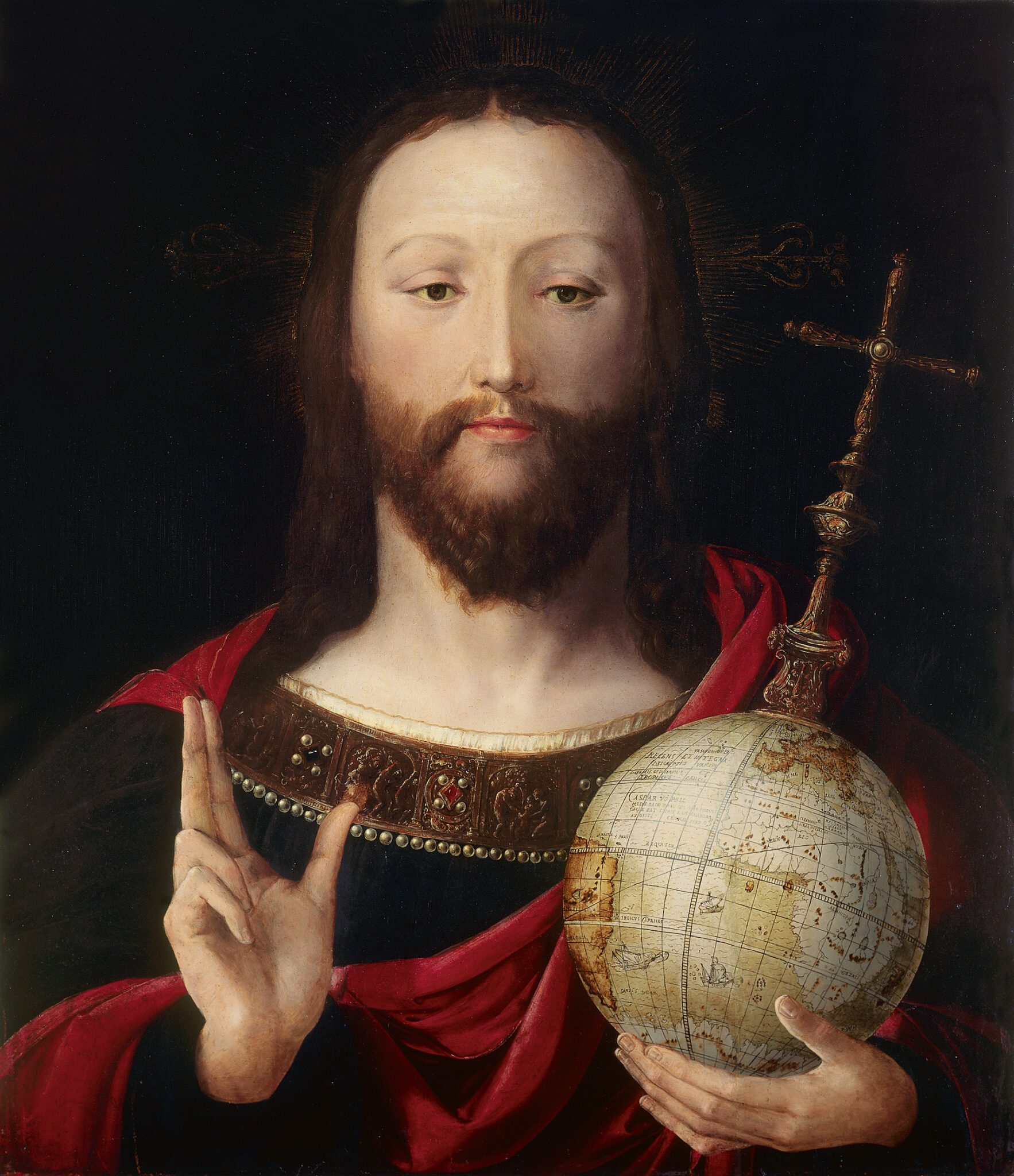
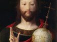
Making such a copy offered the chance to modify the globe in Key’s picture, and there were, as we have seen, many other ways to stage a globe in a painting. Indeed, Rubens was heir to a material record that offered specific options. Artists in the preceding generation had depicted the globe not as an abstract concept, and not only as a geographic denominator, but as a specific material object with a particular provenance that was thus identifiable to knowing viewers. An anonymous Netherlandish picture from the mid-sixteenth century illustrates just how distinctive such cartographic thinking could be (fig. 14). Although in need of nothing more than a generic orb for the iconography of the Salvator Mundi, the painter has delineated a terrestrial sphere with precision. The viewpoint was carefully calibrated, with the globe spun to reveal the entire continent of Africa, a great majority of Europe, the transition to Asia, and (on the left side) the east coast of South America. The globe, that is, offers the viewer all four continents and does so while prominently displaying the name and explanatory description of Caspar Vopel (1511–1561), a cartographer and globemaker active near Cologne.23 This view was reflective of Vopel’s aims of producing, in his own words, “a new complete and universal description of the whole world.”24 The painter provides enough information that the viewer understands Vopel as the designer of this globe and 1537 as its date of production.25
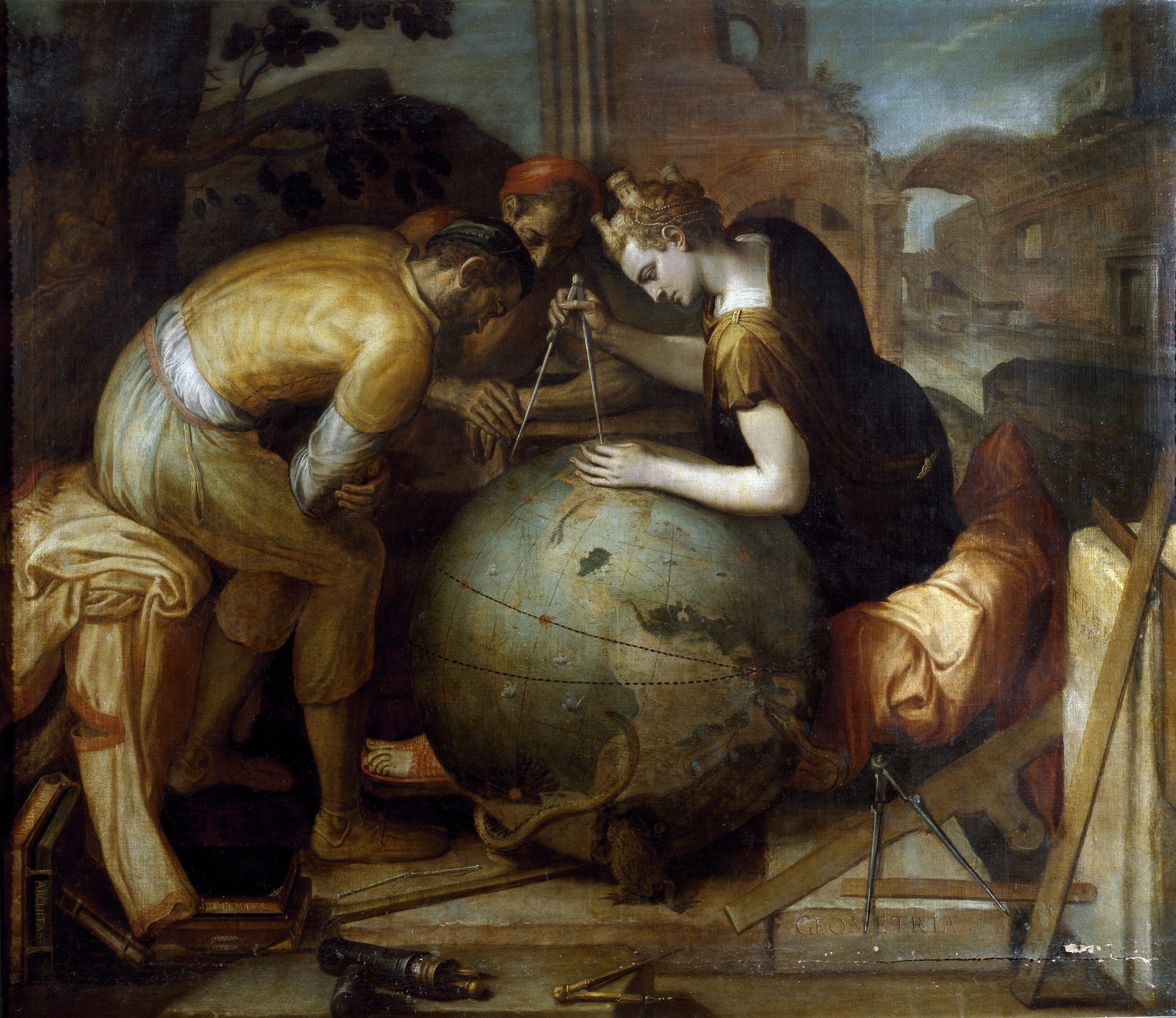
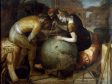
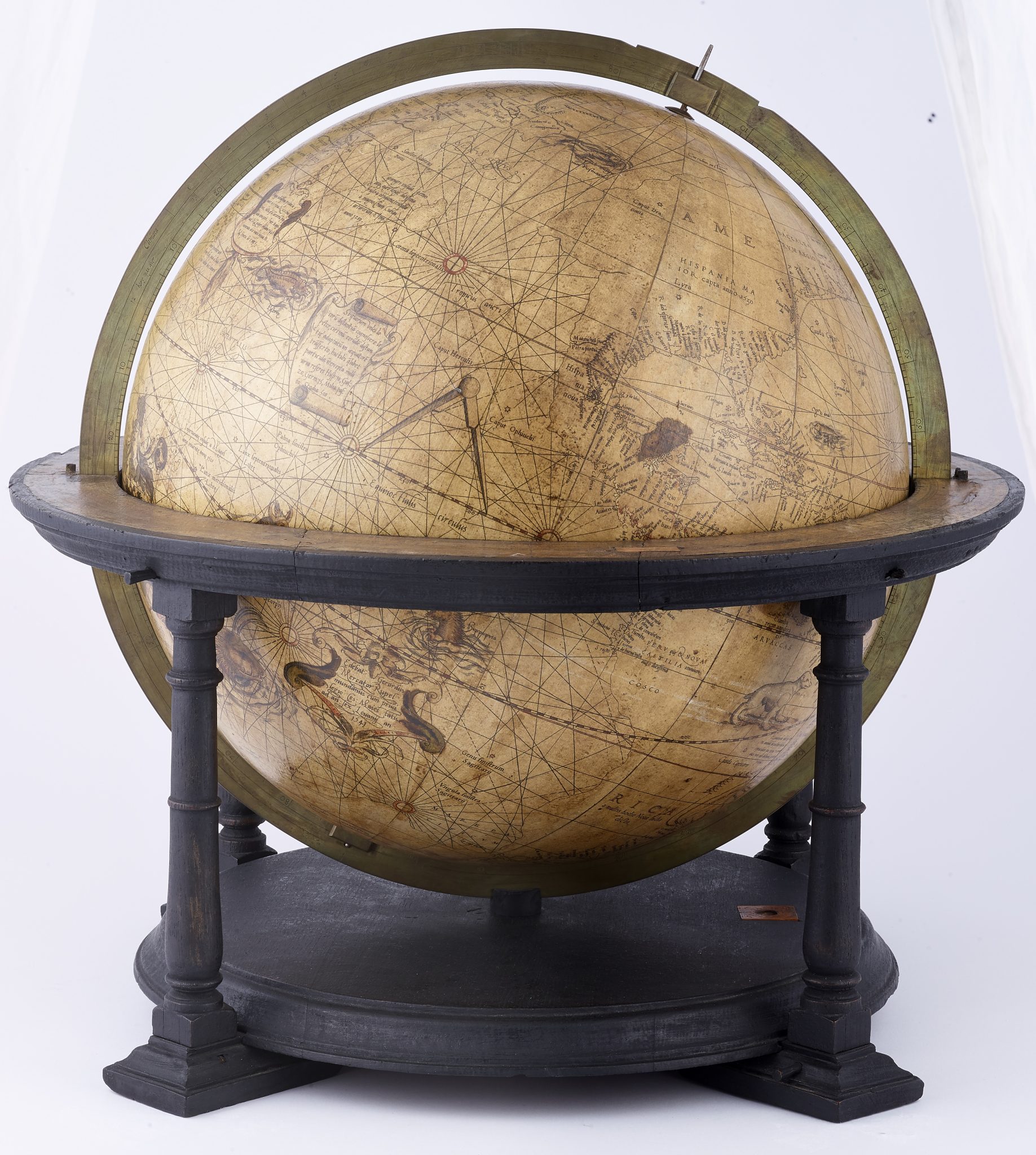
This picture helps to illustrate how painters might be predisposed to think toward globes even when a given subject—like a blessing Christ—did not necessarily demand it and how, in doing so, they could make meaning for audiences evidently interested in the shapes and configurations of the earth’s surface. This was, in other words, how much particularization could be brought to a globe in a picture.26 Admittedly, this example is not one that Rubens himself would (or likely could) have had in mind. But a no less geographically inflected painting by Frans Floris (1517–1570) certainly was (fig. 15). Floris, painting for Nicolaes Jonghelinck (1517–1570), had used the act of measuring the globe as the basis for an allegory of Geometry.27 Floris rotates the globe to display the Americas (both North and South) at the expense of other continental geographies. This is yet easier to see in the printed version, published by Hieronymus Cock (1518–1570), that circulated the composition widely (fig. 16). We can grasp the contours of South America and how the thin strip of Central America loops up and around the Gulf of Mexico. Floris’s referent was recognizable. He copied this view specifically from Gerard Mercator’s (1512–1594) 1541 terrestrial globe, positioning his painting within recent local chorographic and geographic discourses (fig. 17).28
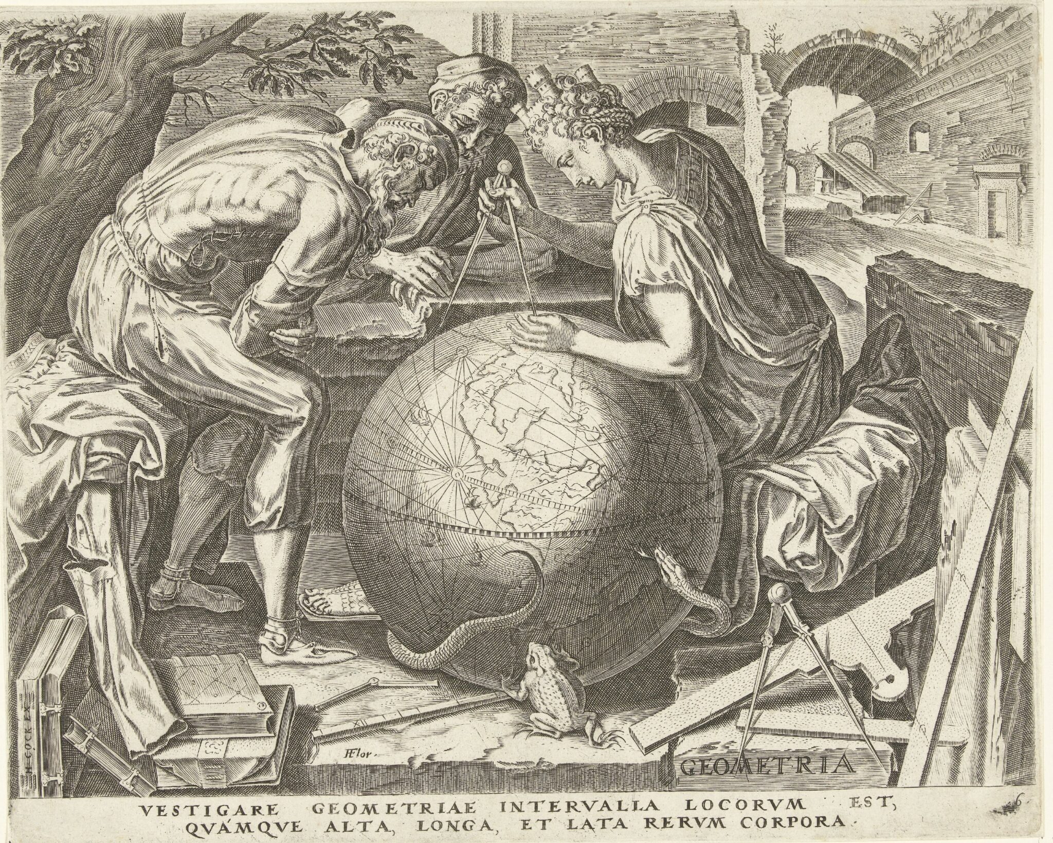
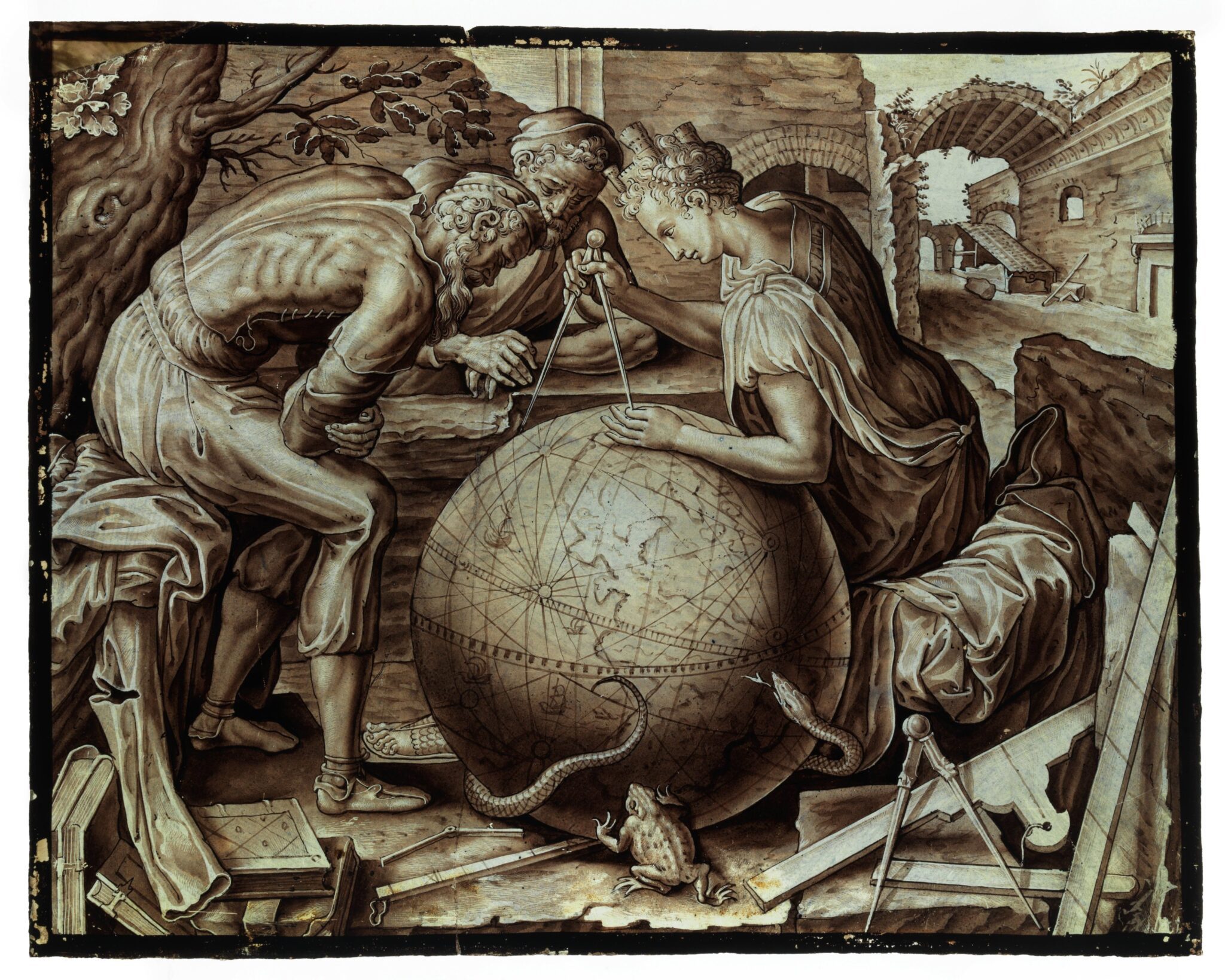
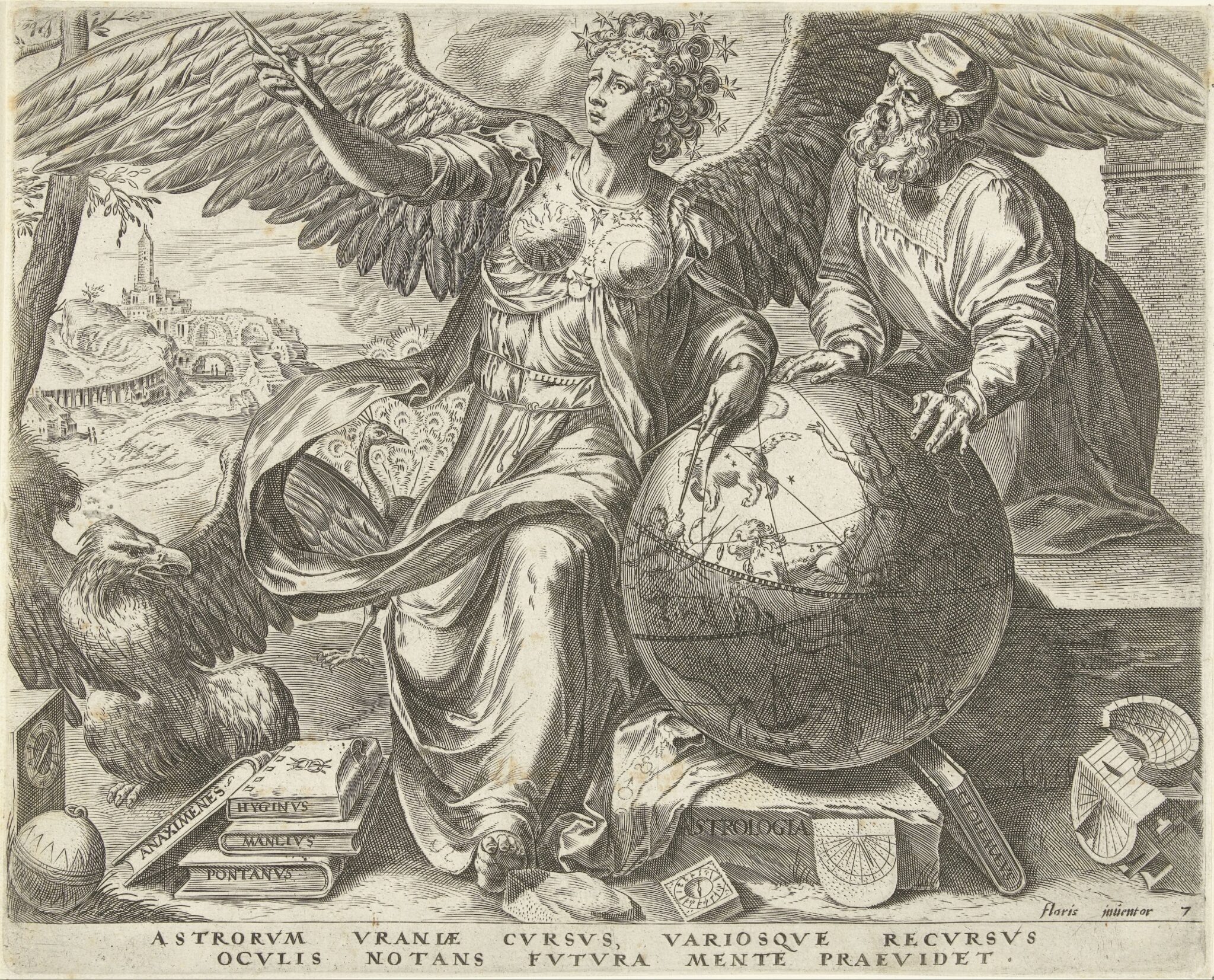
A number of painted glass renditions that follow Floris’s design and carefully preserve this geographic specificity attest that period audiences seem to have cared about this citation (fig. 18).29 For private residence and corporate meeting house alike, artists maintained this particular view of the earth’s surface, transferring the globe and its contents despite changes in both medium and, at times, orientation. The viewers of these windows—just like visitors to Jonghelinck’s suburban villa, where the original painting was housed—were thereby offered a humanist vision that placed the new territories of the Americas at the center of an allegory about one of the oldest branches of human knowledge. This rendition of Geometry was part of a larger series of the seven liberal arts that Floris produced for Jonghelinck. Within this series, Geometry’s pair was Astronomy, who is shown measuring a celestial globe marked with both the signs of the zodiac and constellations, along with the equator and the ecliptic (fig. 19).30 Indeed, globes came in pairs of precisely this sort. Rubens himself, like any gentleman of the era, owned and displayed both types.31 But that hardly prompted him to embrace or elaborate on this kind of knowledge in pictures, even when he painted someone as geographically oriented as Ortelius.
Floris’s pictures usefully counter an assumption that art historians might bring to the art of this period, and to Rubens’s in turn: namely, that descriptive and fiddly mapmaking might be out of step with an Italianate mode of istoria, of pictorial narration centered on the action of figures. We are, after all, inheritors of Svetlana Alpers’s conception of a “mapping impulse” that epistemologically undergirds and almost perfectly approximates the hyper-descriptive visual effects of Dutch art.32 The body-oriented stage-sets of an Italian, Albertian mode would not seem to accommodate so much consideration of surface. Few of Rubens’s northern predecessors were more closely allied with that Italianate art than Floris, who traveled the Peninsula and studied the antique. And yet here that narrative idiom frames the world itself, described with enough pictorial intensity that we can now map, so to speak, its surfaces onto the specific referent of Mercator’s globe.
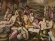
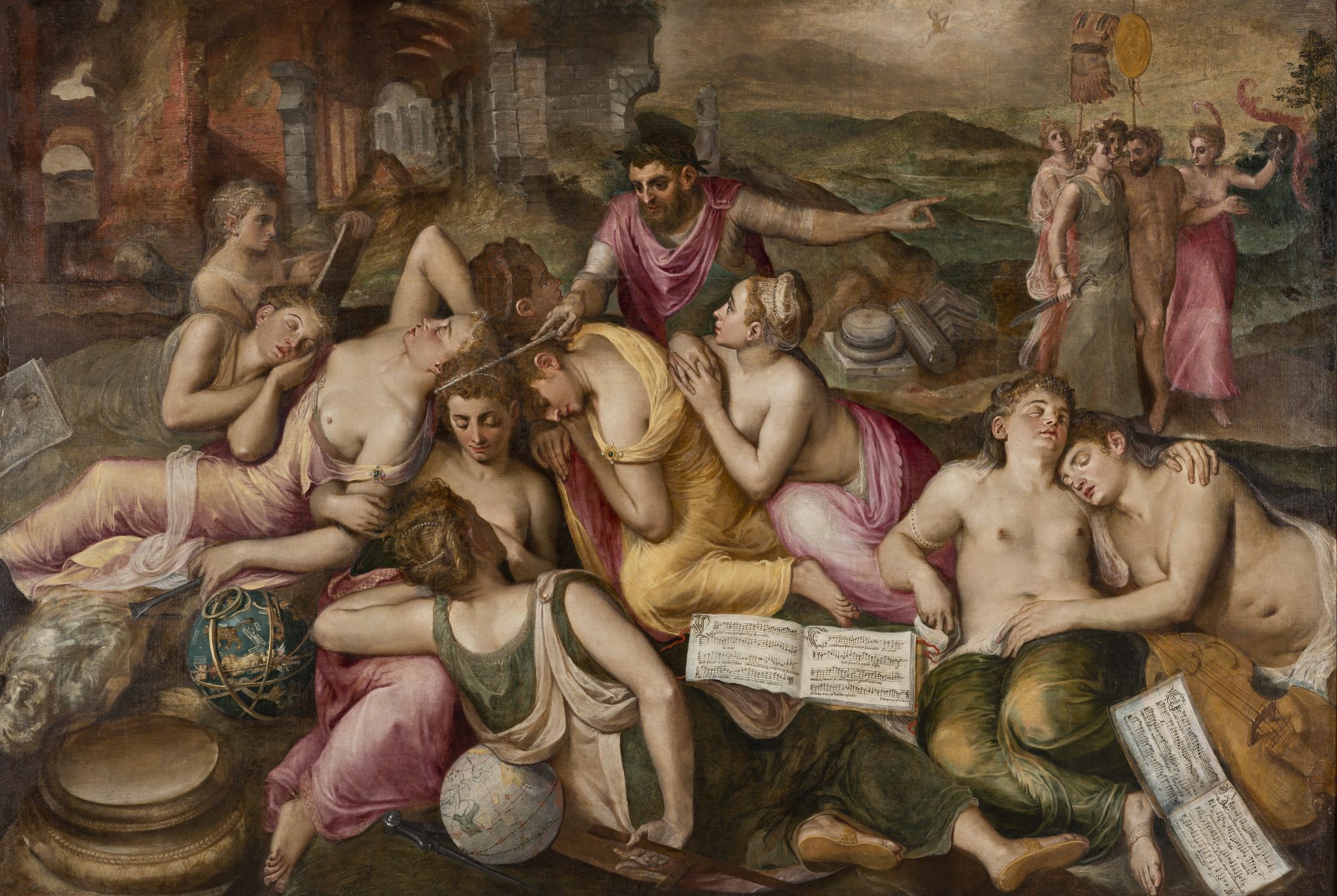
In Floris’s series, terrestrial and celestial orbs are understood as the very grounds for the arts. A pinnacle picture for Jonghelinck’s collection, meant to accompany the seven liberal arts, now shows them all together as a group being awakened from slumber (fig. 20).33 In a twist on the traditional iconography of the liberal arts, the visual arts also appear, now as part of an expanded group.34 Painting is notably already alert and busy transcribing the world around her. Arranged into an arc on the left side of the canvas, Painting’s closest allies—Sculpture and Architecture—also have the tools of their trades in hand, ready to work upon waking. The chisel-holding hand of Sculpture rests on a celestial sphere, while Architecture’s compass keeps the terrestrial orb from rolling away. The celestial and terrestrial spheres thereby provide support for these figures as they sleep and are positioned among their tools, as if they too will be essential for their work upon waking.
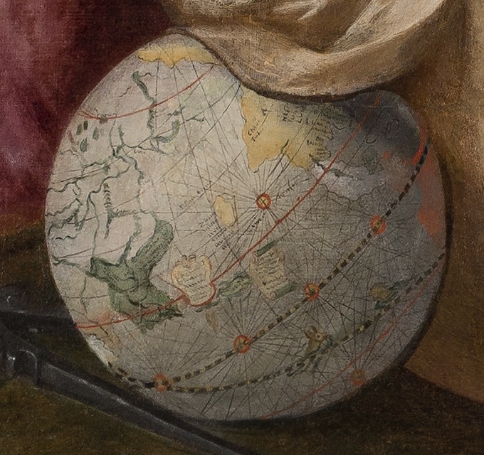
Floris again offers a specific view of an identifiable Mercator globe—one that works in tandem with his earlier picture of Geometry. As Edward Wouk has astutely observed, Geometry measures an interval that the viewer does not see but that is clear enough to understand: all three figures stare intently at the gap between the Americas and Asia.35 Unnoted, however, is that this particular oceanic expanse of the Pacific is precisely what the viewer actually sees in the Awakening of the Arts (fig. 21). Here, the viewer finds (at left) the Indian subcontinent and (at right) the west coast of present-day Mexico as the two most identifiable landmasses, framing a view of the Pacific. If we are as attentive to the Mercator globe as Floris evidently was, we understand him to have particularized the space between Asia and the Americas in Jonghelinck’s series twice over—once as the distance being measured and discussed by Geometry and her companions, and then as the view offered to the beholder and positioned as critical to rousing art from sleep.
Floris’s Awakening of the Arts has long been connected to Antwerp’s local political circumstances within Habsburg Spain’s imperial project. The open books of music, pressed against the picture plane, are specific enough to identify a Franco-Flemish chanson that has been associated with Philip II of Spain (1527–1598).36 Julius Held has even suggested that Mercury, awakening the figures, might be an embedded portrait of Philip, given that the treaty of Cateau-Cambrésis, signed with Henry II (1519–1559) of France in 1559, was widely celebrated in Antwerp for restoring the peace necessary for the arts to flourish.37
If the music keys interest to relatively local politics, however, Floris’s use of Mercator’s globe points to geopolitical developments at an ocean’s remove in the Pacific. Given a large Portuguese merchant community in the city, Antwerp had for decades enjoyed indirect riches from Portuguese trade routes, which ran south and around the tip of Africa before continuing on to the Spice Islands.38 Merchants in Antwerp were thus increasingly invested in the idea that Spain itself could find footholds in the East. In the years leading up to Floris’s paintings, hopes turned more concrete. As early as 1543, expeditions from New Spain were sent to the archipelagos off mainland China, and while those areas would wait until 1565 to be conquered for Spain by Miguel López de Legazpi, the chance was already taken to name these islands after Philip II—las Islas Filipinas. Thus the Philippine Islands were inaugurated with the name of the very king invoked within Floris’s picture, via both the notably legible musical scores and the portrait-like figure of Mercury-Philip (if we follow Held’s assertion) who awakens the arts. Just as importantly, the oceanic interval that would link these islands to Spain’s empire is visualized twice within this same series. The measurements taken by Geometry and her companions may even reference the idea that the islands could be rightfully possessed by Spain. Though it is harder to historicize this point, eastward expansion certainly led to discussions about the validity of the measurements that undergirded Spain and Portugal’s divvying up of the world via the Treaty of Tordesillas (1494).39
European treaties and restoring local trade might secure riches for Antwerp merchants and the artists in their employ, thus awakening the city’s arts, but these profits paled in comparison to those that would be won if Spain were to control a westward route to east Asia. These are large themes to emerge from the presence of a couple of globes in paintings. Yet the globes’ prominence and the particularization of their surfaces suggest just how much meaning they could offer artists and their patrons. The globe was an object capable of pulling emerging geopolitical realities into the space of a picture.
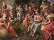
Those geopolitical circumstances continued to evolve, such that when Maerten de Vos (1532–1603) took Floris’s series as the basis for his own picture of the liberal arts, he shifted the view of the globe to reflect recent developments (fig. 22).40 It is evident that De Vos was working from Floris’s earlier series, most likely from the prints that had been made after the paintings for Jonghelinck; the figure of Astronomy being visited by Mars, which acts as the composition’s fulcrum in the center middle-ground, is directly copied from Floris’s version (see fig. 20). De Vos has gathered the other liberal arts into a single composition around her. There, Geometry, seated at left in the foreground with her walled-city crown, identical to the one she wears in Floris’s composition, still holds her compass and measures out a terrestrial distance on the same version of Mercator’s globe, one that remains positioned to offer the beholder a view of the Americas.41 Here, though, that globe has been rotated forward to expose areas further to the north, with Geometry’s compass now anchored not on the American coastline but in the Arctic, a shift that has been significantly highlighted through de Vos’s addition of two concentric red circles marking the North Pole.
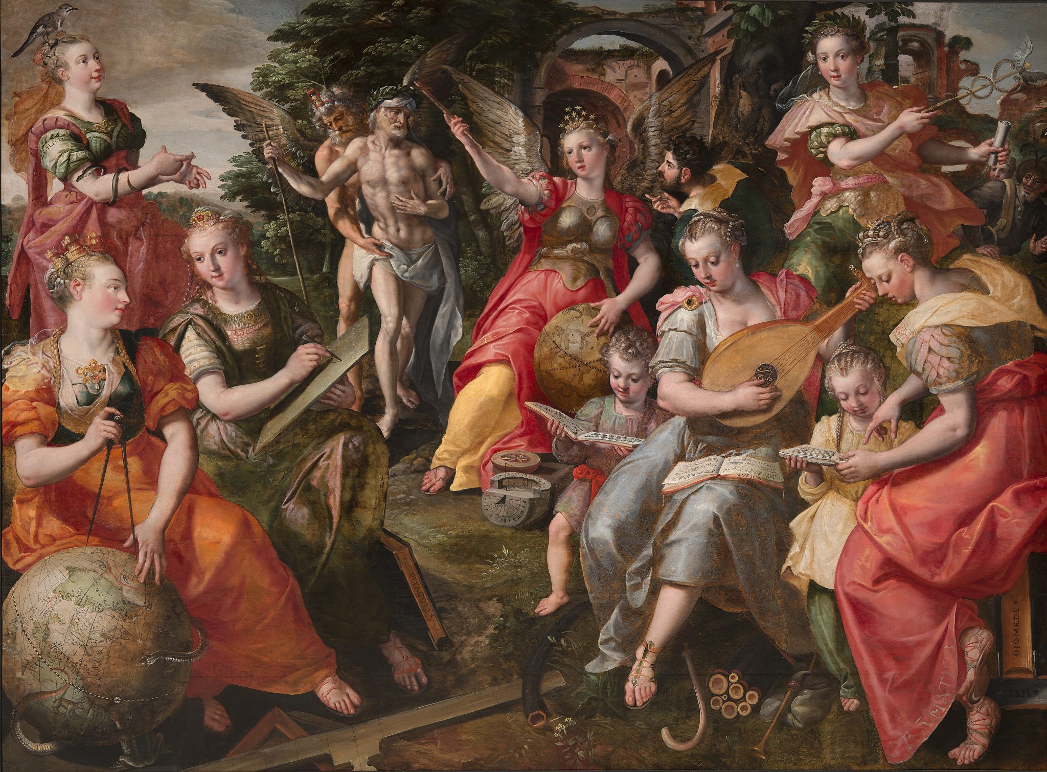
While a firm date for this picture has never been established, the globe’s view—and its shift of Floris’s model—suggests the 1580s.42 Spain’s control of a route to the West—to the Americas and onward to Asia—was already coming under pressure in precisely this period. In 1576, 1577, and 1588, Martin Frobisher led expeditions in the name of the English and the Company of Cathay to discover a northwest passage from Europe to the Pacific Ocean that would circumvent the Spanish Americas and enable uninterrupted long-distance trade with Asia.43 These voyages were widely celebrated in printed texts that circulated both in Britain and among anxious imperial rivals. By 1582 Richard Hakluyt included these expeditions in his Divers Voyages Touching the Discoverie of America, thereby explicitly positioning these geographic explorations vis-à-vis Spanish dominion over the American continents. The text included an excerpt of a letter from none other than Mercator—by this point decamped to Protestant Duisberg to flee Spain’s control and religious realignment of the Southern Netherlands—that underscored the potential financial rewards: “For there is no doubt, but that there is a straight and short way open into the West even onto Cathay. Into which kingdome, if they take their course aright, they shall gather the most noble merchandise of all the worlde. . . . Spain [and] King Philip . . . have not the people to possess and keep that passage.”44
That De Vos both adopted and shifted the globe helps to draw out the time-dependent, politically sensitive nature of Floris’s handling of the motif to begin with. The route that Spain had, by later in the sixteenth century, firmly established with Asia via the Philippines was old news, no longer a pressing matter. Rather, attention had turned to the arctic zone, fueling anxiety about how durable and exclusive Spain’s and (by extension) Antwerp’s tether to the east via the Pacific might be.45 In citing Floris, De Vos thus recognized the geopolitical ramifications of Floris’s allegory of Geometry but recast the geography under consideration to reflect the imperial realignments taking place across the earth’s surface. These artists carefully calibrated a view of the earthly sphere to respond both to one another and to evolving geopolitical concerns, such that the globe’s meaning compounded.
Positioning
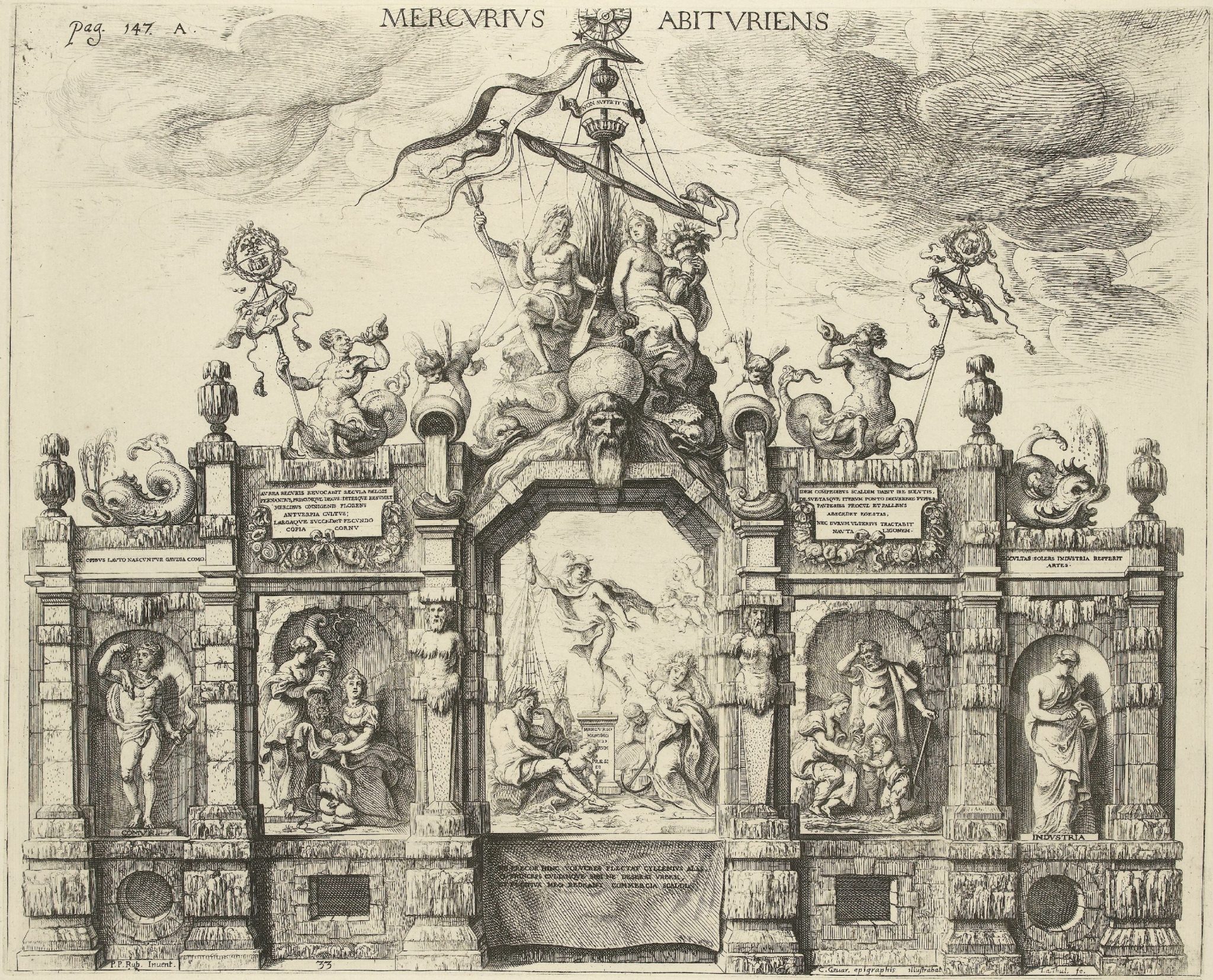
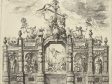
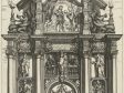
In contrast to these examples, Rubens’s orbs and globes appear insistently blank. This is perhaps nowhere more evident than in his designs for the Pompa Introitus Ferdinandi, the triumphal entry of the Cardinal Infante Ferdinand to Antwerp, which took place in 1635. The Stage of Mercury, which served to establish one of the key messages to Antwerp’s would-be ruler, was set up around a globe, which functions as a fulcrum above the central scene (fig. 23).46 In his written description of the festival, Gaspar Gevartius underscored this arch’s geographic valences, which served to communicate Antwerp’s struggling economy: “There was a time when Oceanus and Neptune served Scaldis by bringing to his harbor [Antwerp] the merchandise of all the peoples of the globe, and [they] in turn poured back goods for distribution throughout all the regions of the world.”47 As we have seen with Floris and De Vos, those regions could be carefully described and calibrated within the space of early modern pictures. But in the etching that preserves Rubens’s design, a globe resting on the head of Oceanus gives no sense of any specific geography—the earth’s particularities dispersed into a spidery web of thin non-landmasses that stretch across its surface. Neptune, with his rudder of rule, would have plenty of space to sail the open seas on this orb but very few known landmarks via which to orient his ship.
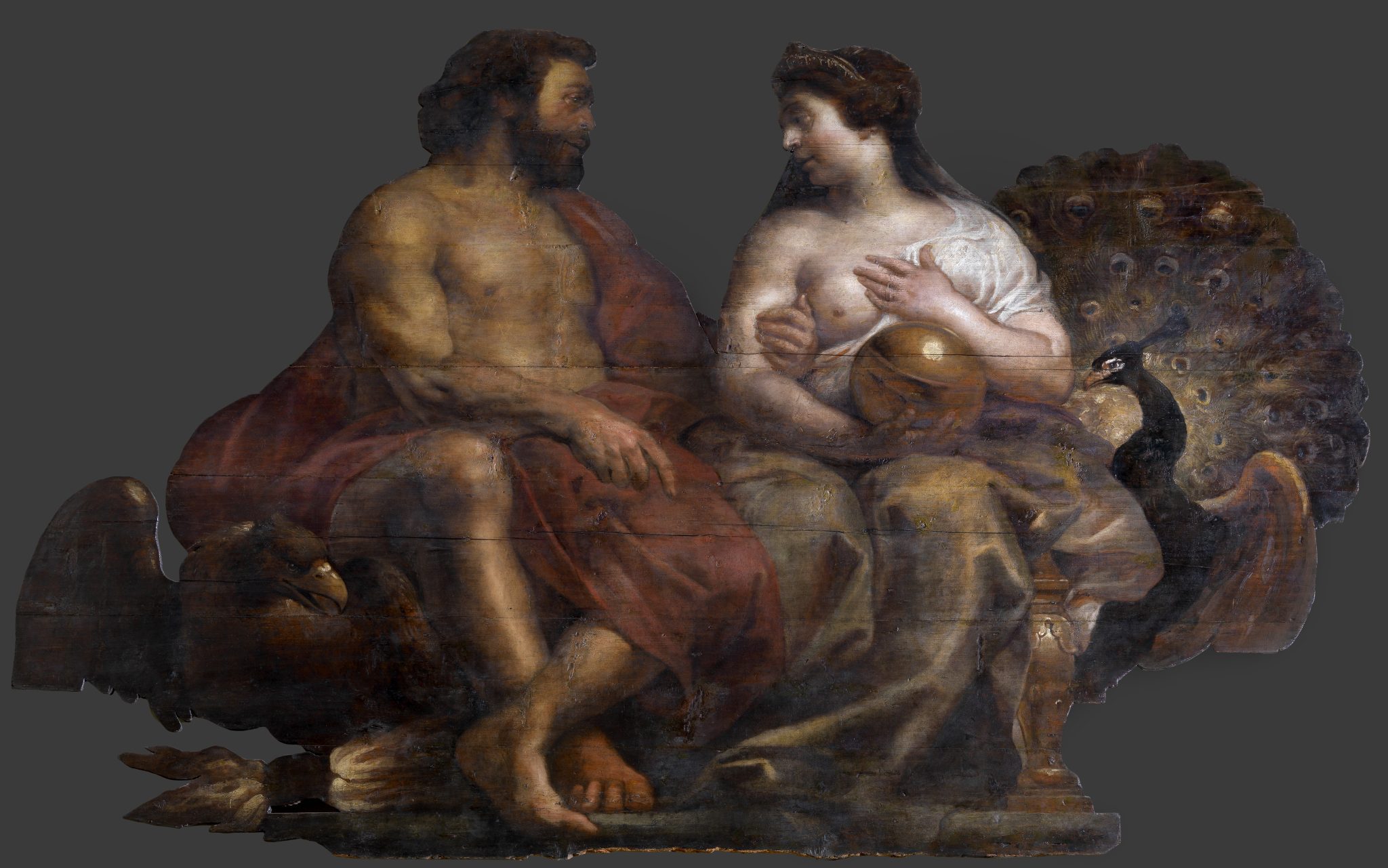
These designs were, of course, meant to produce ephemeral stage sets that largely no longer exist. We might thus presume that the etchings, meant to accompany Gevartius’s commemorative festival book, were but hazy reflections of Rubens’s initial designs. In this case, however, Theodoor van Thulden (1606–1669)—who was responsible for the book’s etchings—had also been the painter assigned to produce, along with a team of four apprentices, the final version of the Stage of Mercury for the streets of Antwerp. He was thus particularly well positioned to capture and rehearse geographic specificity, if that had indeed been the goal. More to the point, the oil sketches and pieces of finished stage sets that do survive invariably show the orbs as gleaming, reflective, and golden—visually impressive, but smooth and empty (fig. 24).48
Time and again, across the various iterations of these compositions for the festival, we find an impulse of de-particularization. This occurs threefold on Rubens’s design for the arch of Philip IV (1605–1665), King of Spain, another installation for the Pompa Introitus Ferdinandi (fig. 25).49 Between Apollo holding the Sun and Luna brandishing the moon sits an allegorical figure of the Habsburg monarchy amid a halo of zodiacal signs; the twelve signs are carefully differentiated, and yet the orb is burnished to blankness. Directly below, in a scene of a Habsburg marriage by which earthly kingdoms were secured, is another globe without territory. Lastly, Isabella of Castile (1451–1504) holds out a sphere to her husband, Ferdinand of Aragon (1452–1516), across the arch, with the viceregents between them. But this is, we might say, a hollow offering.
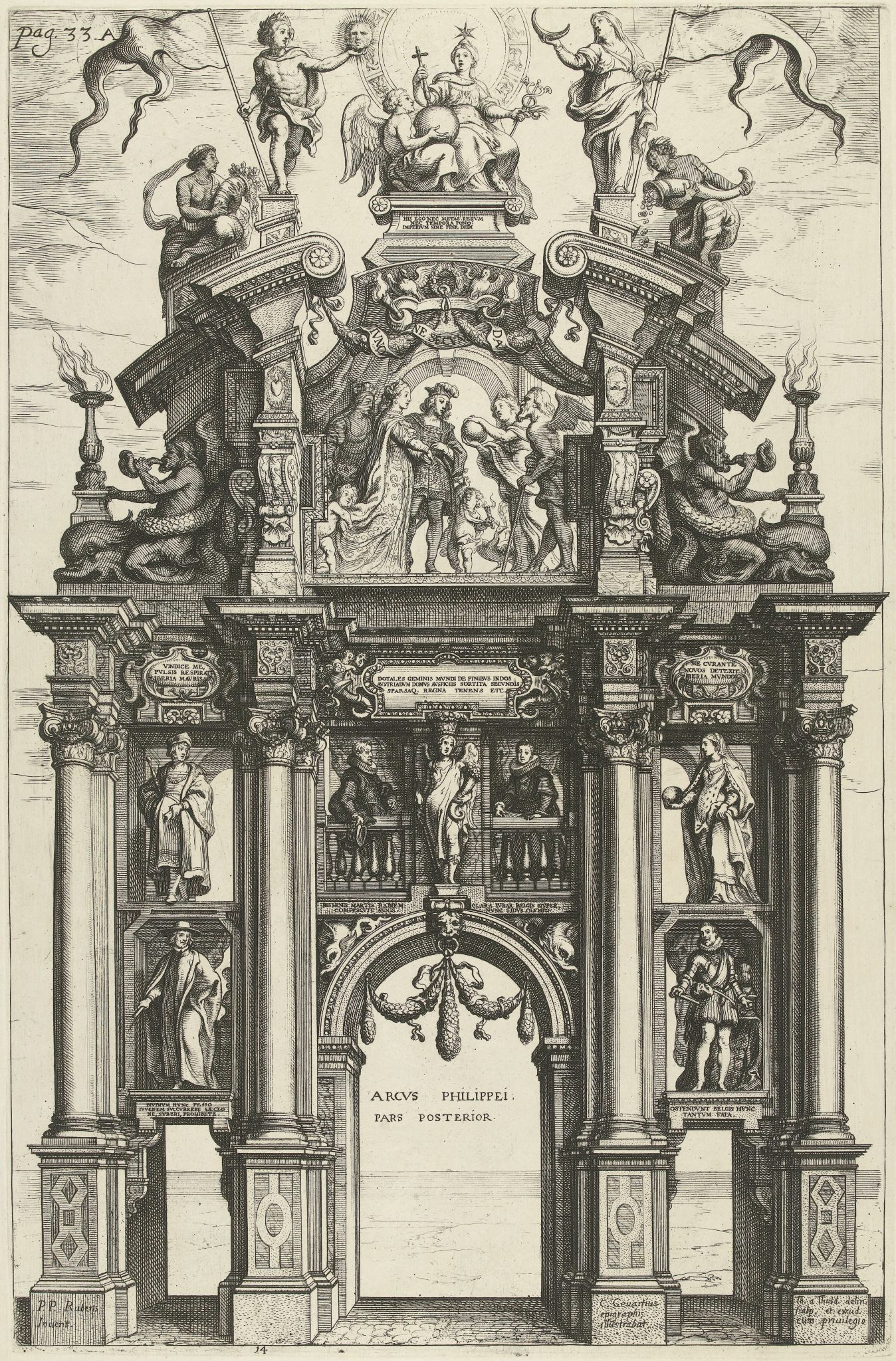
Three orbs, three opportunities—none taken. This might have been an obvious place to do so. For as Gevartius informs us, the arch of Philip IV was meant to communicate the vastness of Habsburg territories acquired through marriage and conquest. The inscription devised for the arch’s pinnacle, a quotation from the Aeneid, underscores the point: “For these I set no boundary nor periods of time: I have granted them empire without end.”50 With three globes, Rubens had enough space to actually visualize those territories and, with them, an empire extending so far east and west that in it the sun famously never set—an empire thus exceeding the perspective of any single vantage point on the globe as an object. Each globe could have shown a different piece of the Habsburg world, visualizing the entire scope of the empire from which goods flowed to the metropoles of Europe. One might imagine that it would have been difficult for spectators to view such details once high up on the installed arches. But triumphal entries were interpreted by knowledgeable guides to the event and then reinterpreted through the production of festival books, such that all manner of fiddly allegories, ones seemingly dependent upon close viewing, could be and were included for these entries, that of the Cardinal Infante no exception.51 Yet instead of offering geographic expanses in pictorial form, Rubens allegorically reduced them on this arch to two figures of the Indies, women who are set in the shadows of the sun and moon gods at the top right and left of the arch’s composition.
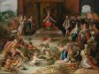
If ever Rubens’s broad-brushed pictorial language might have yielded to the specifics of the globe, one might expect it to have been here in the Pompa Introitus, where the conventions of political allegory demanded densely layered detail. Indeed, artists in Rubens’s direct milieu pushed his motifs in that direction. To this point, we have attended to how artists working in Rubens’s wake, following his compositions, interpolated the globe into the blanks he left for them, and we have seen historical precedents, among them works by Frans Floris and Maerten de Vos in Antwerp, for particularized and detailed treatments of the globe’s surface. This section turns to a case that is contemporaneous with Rubens and positioned the globe to key attention to specific geographies and, with them, particular political developments: Frans Francken II’s (1581–1642) half-historical, half-allegorical pictorial rendering of Holy Roman Emperor Charles V’s (1500–1558) abdication of the throne (fig. 26).
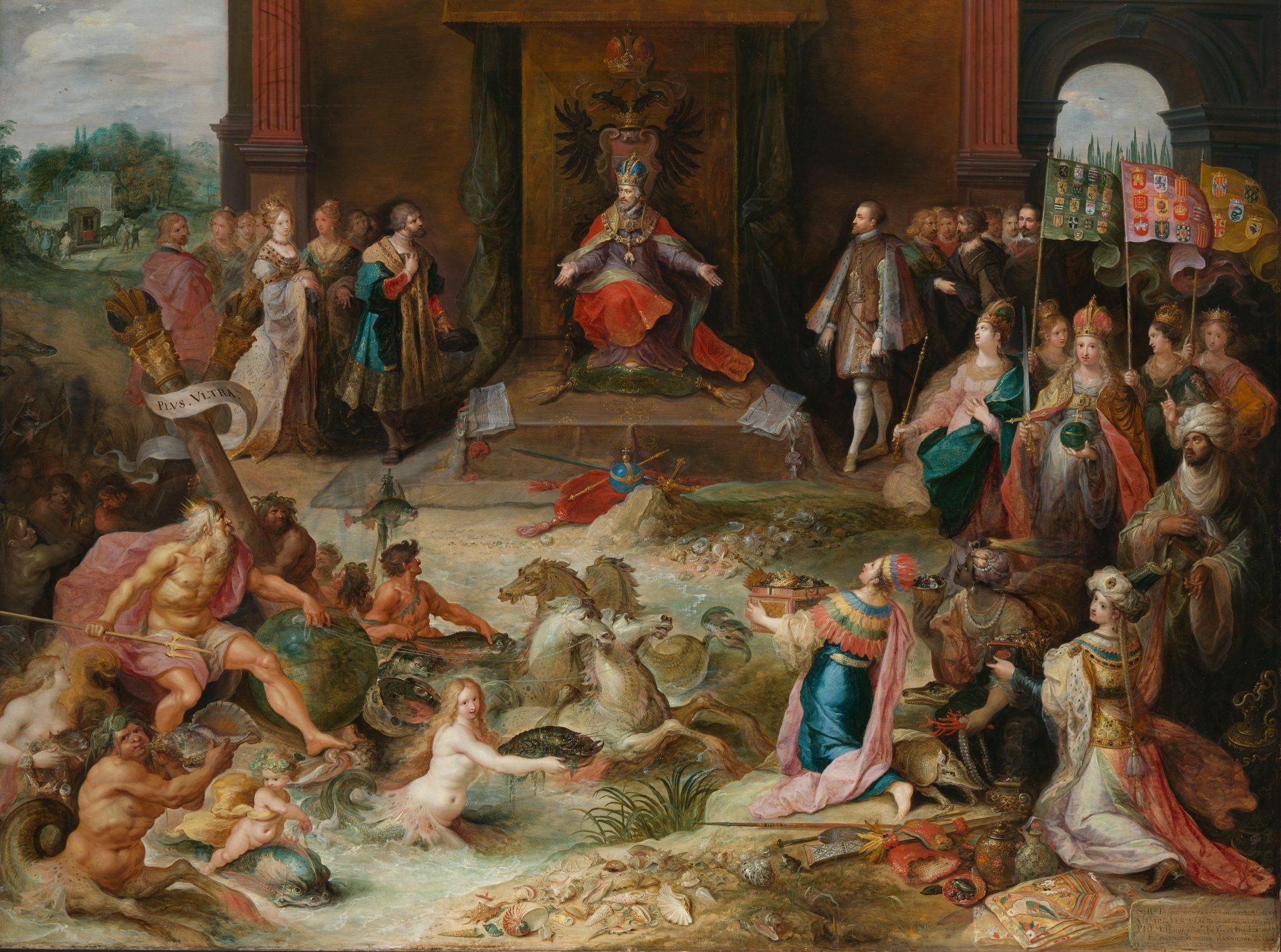
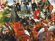
The busy painting shows Charles still enthroned but gesturing downward to royal charters he has torn asunder and toward his successors, Ferdinand (1503–1564) and Philip II.52 The context for the creation of the work in the 1630s has proved enigmatic.53 It is clear, however, that it was made in the wake of designs for the Pompa Introitus and, even more generally, with Rubens in mind. In what follows, I will lay out those connections, using Rubens’s blank globes as a starting point to show how Francken turned these sources toward specific geographies and, with them, toward a geopolitical topic that was of critical contemporary import in the transatlantic sphere.
In devising The Abdication of Charles V, Francken drew on Rubens in two ways. First, he pulled from Rubens’s depiction (ca. 1609; Museum of Fine Arts, Boston)—which itself followed Jan Vermeyen’s (ca. 1503–1559) model (known now through a ca. 1535–1536 print)—of Mulay Ahmad (1500–1575), the ruler who offered critical support to Charles V’s Tunisian campaigns.54 The turbaned figure can be seen in green robes on the right-hand edge of Francken’s picture. Second, Francken turned to Rubens’s designs for the Cardinal Infante’s entry into Antwerp, probably in their printed form. He specifically repurposed Rubens’s watery chariot of Neptune drawn forward by four wild-eyed horses, for the allegorical drama that unfolds at the foreground of his own scene (fig. 27). Rubens’s deployment of this ensemble was oriented to European geographies: Neptune rises from the sea to calm the stormy waters that threaten the passage of the Cardinal Infante’s fleet—seen in the background—from Barcelona to Genoa.55 Francken recast the intra-European motif to decidedly global ends. Neptune now sails past the pillars of Hercules with such force that his attendants struggle to keep them from toppling in his wake. The crown’s motto “Plus Ultra” winds around on a banderole.
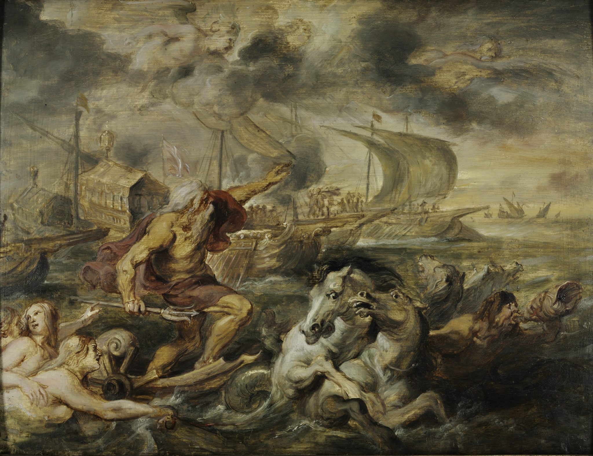
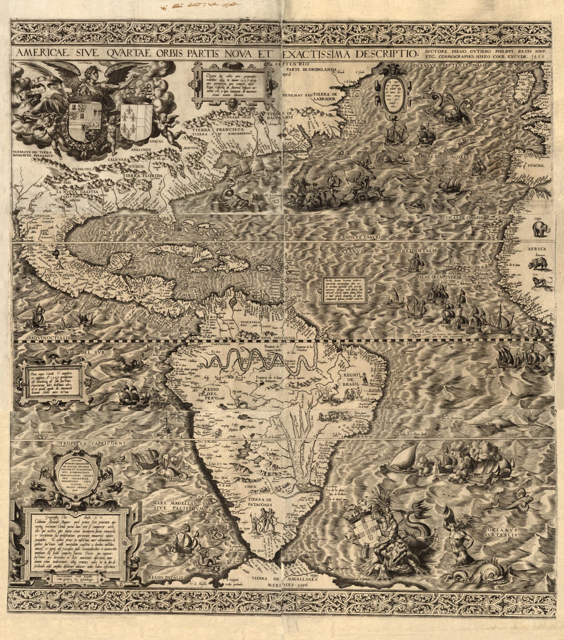
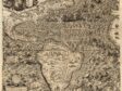
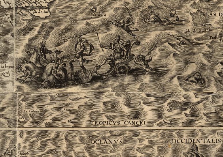
The Pillars of Hercules are not just an allegorical abstraction geared at expansion but also denote a specific geographic referent: the Strait of Gibraltar, a boundary beyond which, in the classical world, little had been known. This abruptly changed with the “discovery” of the Americas, which Francken references in multiple ways. The lead horse of Neptune’s chariot makes landfall directly in front of the personification of America—arms outstretched, offering the precious metals found there in the form of crowns, alluding to those forfeited when local rule was handed over to (or forcibly taken by) the Spanish. The entire motif recalls the inset detail on the famous 1562 map by Diego Gutiérrez (active 1554–1569), published by Hieronymus Cock (fig. 28).56 In this first large-scale map of the Americas produced in Antwerp, Neptune guides a sea-borne chariot directed by Philip II, shown here claiming sovereignty over the transatlantic channel that had, by this point, become critical to Spain’s empire (fig. 29). In Francken’s composition, Neptune stares up at Philip II, promising the aid he provides in Gutiérrez’s map.
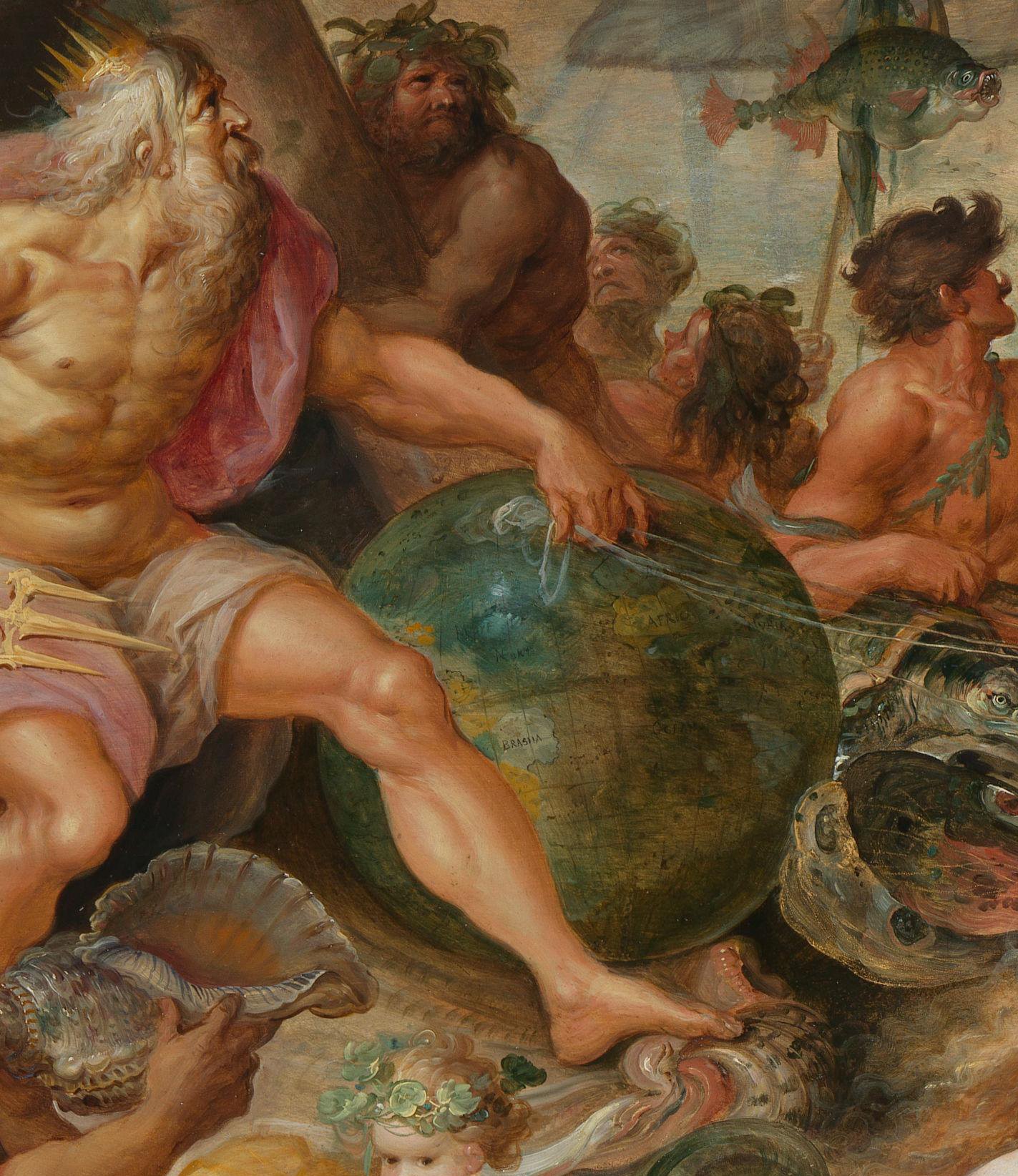
That Francken was thinking specifically about the domain of mapping is made clear not only by his inclusion of a terrestrial globe but also by his specific treatment of the geography featured on its surface (fig. 30). Francken’s Neptune—like Gutiérrez’s Philip—quite literally bridges the Atlantic world. His leg is bent to the very shape of the Americas, and his arm is outstretched as if to grab onto Europe like a handle. But in so depicting him, Francken left exposed a very particular edge of South America, the Brazilian coastline, to which an added label draws attention. And while the figure of America is presented with generic, stereotyped feather adornments, the specific implements on the ground behind her—a red feather hat, decorated club, and painted spear—were understood, by the seventeenth century, as stemming from the Tupinambá populations on the coast of Brazil.57
But why would Francken draw attention to this sliver of the globe in an allegory about an empire so vast that Charles V felt ruling it was beyond the grasp of a single individual? And why highlight a territory that was never under direct Spanish control—neither Charles V’s nor Philip II’s? We can answer these questions by putting the picture into dialogue with something of a twin work, an Allegory of Homage to Apollo, that Francken signed in 1629 (fig. 31). At the pinnacle of this compositionally apposite painting, Apollo sits enthroned on a dais, as allegorical figures of the four continents offer their riches to the sun god. As Elizabeth McGrath has amply demonstrated, Apollo here stands in for the Spanish monarchy, which took the mythological figure as an emblem of their rule, given that he controlled the sun that never set on their globe-stretching domains.58 Moreover, there was precedent in Antwerp print culture for showing the four continents as allegorical figures bringing bounty to the imperial house.59 Again, Francken makes the globe play a prominent role in the foreground of the composition, on an axis with Apollo; and again he focuses attention specifically on Brazil, displayed at the dead center of this sphere, highlighted with thick lead white and labeled. Francken pairs this globe with America, who hovers over and leans atop the sphere, as if claiming it as her own attribute and highlighting the view of Brazil that she exposes and frames.
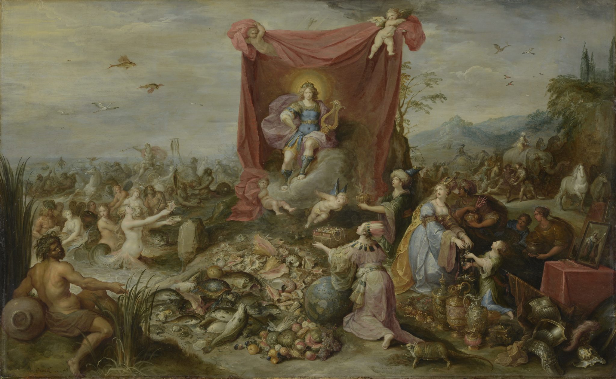
Francken’s focus on the Brazilian coastline produces an important temporal elision when we reconsider his allegory of Charles V’s much earlier abdication. At that point, in 1556, Spain had no rights to Brazil, which was controlled by Portugal via the dividing line of the Treaty of Tordesillas. But Francken was not painting during Charles’s reign, and the political situation had changed by the time he created both of these pictures some seventy-five years later. By 1580, the two crowns were joined in an Iberian Union of Spain and Portugal, initially under the leadership of Philip II—a geopolitical realignment that lasted until 1640. This meant that Antwerp could, as a shipping port and home to communities from both sides of the Iberian Peninsula, enjoy riches from trade routes reaching in opposite directions across the globe. Indeed, for the festival book accompanying the triumphal entry of Archduke Ernst of Austria (1553–1595) into Antwerp in 1594, the commentator Bochius took the chance to note that the “power of King Philip . . . was indeed very greatly increased through the acquisition of the maritime empire for which the Portuguese are celebrated beyond all others.”60 The growing awareness of the economic importance of this political union also meant that citizens in Antwerp were increasingly sensitive to the fates of Portuguese territories in precisely the years that Francken painted his pictures.
Attention had turned to the Dutch, who in 1624 managed to capture, from the Portuguese, the Brazilian city of Salvador. This victory was short lived. Less than one year later, a massive Spanish brigade ousted the Dutch from Brazil. They continued, however, to menace. In 1628, Admiral Piet Hein (1577–1629) cornered and captured the so-called Silver Fleet—a Spanish galleon—off the coast of Cuba.61 The seizure of precious cargo was a windfall for the Dutch Republic. Even more importantly, this stolen silver bankrolled the struggling Dutch West India Company to such an extent that it could not only consolidate its finances but also set its sights anew on Brazil.62 A year later, in 1629, the Dutch departed with their ships again trained on the Brazilian coastline, and this time their efforts would be longer lasting.63
Brazil and the year 1629—both are central to Francken’s painting of Apollo/Habsburg global dominion. On the globe, Brazil is highlighted, and the year 1629 is inscribed in the framed work (within the painting) directly next to a portrait of a robed king. Both place and date are thus positioned in relation to the question of imperial control. That is, in the very same year that the Dutch sought to seize control of Brazil, Francken visualized this specific territory as critical to the gifts that America could offer the Spanish crown. Neptune riding the seas in the composition’s background suggests that, if the Spanish king ruled over an empire on which Apollo’s sun never set, it was because of Habsburg control of transatlantic waters. Neptune, as the (literal) right-hand man of the ruling Apollo figure, stands not as a generic sign of sovereignty but rather as the specific force needed to counter the palpable threat menacing Iberian transatlantic investments.
Full Dutch control of Brazil would only come in 1636, and one year later the Dutch named Johann Maurits (1604–1679) governor of this area, now dubbed “Nieuw Holland.” This sealed the fate, at least for some twenty years, of the rich sugar-producing territories of Brazil that would now yield dividends for the Dutch West India Company rather than for the still-unified Iberian Crowns and, by extension, Antwerp’s citizens. As Michiel van Groesen has recently explored, Antwerp’s burghers were extremely attuned—in a granular, politically evolving way—to the fates of the Brazilian territories, such that artists could reflect on these themes for Antwerp’s art market in everything from landscapes to battle scenes.64 Indeed, one of the most critical aspects of van Groesen’s examples, as with the ones discussed here, is how immediately art reflected emergent geopolitical shifts. The works in the present essay almost invariably reflect on happenings and matters that had only just begun to circulate through print or that even preceded widespread public writing, indexing the quite rapid ways that news spread through political and interpersonal information channels.65
Putting Francken’s pictures into relationship with contemporary political events via his particularized treatment of the globe also helps to assess the circumstances of his turn to the theme of Charles V’s abdication (which occurred in 1556) in the late 1630s. At first glance, this seems an odd choice. Yet we might recall that Rubens took the opportunity of the Pompa Introitus in 1635 to decry the impoverishment of Antwerp’s local harbor economy by Dutch blockade and taxation: he pictured a sleeping River Scheldt and Mercury fleeing to better, more active locales properly supported by Spain and its imperial forces.66 Francken’s picture, which drew on Rubens’s designs and was thus necessarily painted in the years of Dutch consolidation of control over Brazilian lands, functions as something of a global addendum.67 The painting points to yet another Spanish loss at the hands of Antwerp’s neighbors to the north, but now in the transatlantic sphere. Moreover, it pairs that geopolitical development with an imperial event featuring the very emperor who secured this territory for Spain and its empire to begin with, along with the successor who cemented that dominion via a union of the crowns. These were geopolitical wins that were now, in Francken’s moment, being challenged.
Positioning northeastern Brazil and its seizure as critical to this story may also make sense of an odd iconographic feature that has puzzled scholars. The three known extra-European continents of America, Africa, and Asia, in the form of luxuriously clad women, are clustered at the lower right. To some extent, an allegorical embodiment of this type for Europe would be unnecessary, given the plentitude of other European rulers and symbols on offer. Yet we find not just one but two blonde-haired maidens that seem to stand in for this concept in front of the banner-wielding group.68 They share between them the three implements of dominion that are also laid down before Charles: orb, scepter, and sword. We might think of these two blonde women as representing his territories, divided in two and ceded to the would-be rulers at his sides. But given the transatlantic dynamics that Francken’s pictures seem to have responded to, these figures might instead be understood as the two crowns that had been brought together under the dominion of this single house: Spain and Portugal, an Iberian Union menaced by Dutch incursions.
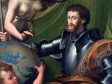
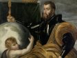
These readings, and this register of contemporary politics, emerge from an attentiveness to the globe within the pictorial field by an artist sensitive to the views that it could offer. As this essay has suggested, Rubens was not such an artist. Another example, also made specifically in relation to the politics of Charles V, underscores this assessment and serves as a useful counterpoint to Francken (fig. 32). This was a portrait of Charles by Parmigianino (1503–1540)—seemingly with significant workshop intervention—that was celebrated by none other than Vasari, who describes “Fame crowning him with laurel, and a boy in the form of a little Hercules offering him a globe of the world, as if to give him dominion over it.”69 The flat gold of that globe makes the geography tricky to grasp at first glance, but it clearly shows the eastern Mediterranean, centering Charles’s standing as Holy Roman Emperor and protector of Jerusalem at the center of our view. The youthful Hercules, and a small detail of his pillars on the sheath of Charles’s sword, underscore the monarch’s equally important role in securing the broader Atlantic world.
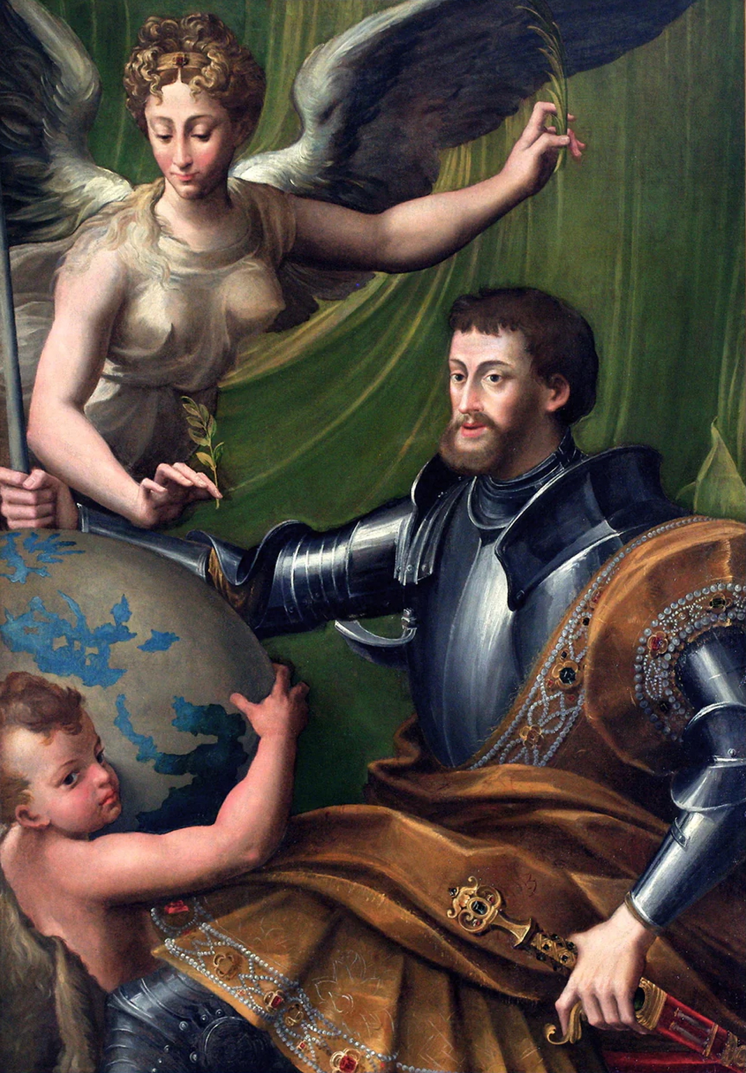
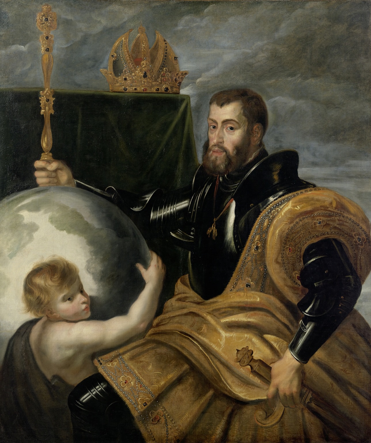
The picture ended up in the collection of the Duke of Mantua, which gave Rubens the chance to copy it during his employment at court (fig. 33).70 When he did, he swapped out the figure of fame and the green drape of honor for a dramatic sky. Crucially, he also erased any trace of geographic specificity, ignoring the Pillars of Hercules entirely and turning the globe into a generic assemblage of green and blue. It is one thing to have not gone to the trouble to think about the globe in his own work, but to both scramble and efface the traces of a broader world through this act of copying should likely strike us as more aggressive—less an index of Rubens’s global inattentiveness than of disinclination or even resistance.
Old Worlds
In the wake of the discipline’s global reorientation, art historians have turned a new lens on the careers of major artists and thinkers of the past, scouring them for intersections with a world beyond Europe’s shores.71 Indeed, if we have learned anything from postcolonial thinkers, surely every European project in the age of colonial extraction was undergirded by globality.72 And yet, some of the period’s most renowned visual thinkers are remarkably withholding on this score. This essay has described Rubens’s global inattentiveness, an aversion to thinking carefully about the global reconfigurations of early modernity. Doing so reveals a methodological dilemma: what happens when the objects and people of our current historical gaze refuse to play along, when they refuse—in this case—to be global?
Paradoxically, a certain kind of answer comes from looking at the infrequent instances in which Rubens did decide to carefully visualize the globe. I cannot emphasize enough that these are, again, rare exceptions. Were this article to include even a substantial portion of the pictures in which Rubens chose not to particularize an orb or a globe—allegories of rulership with globes emptied of territory,73 the Virgin treading or God leaning upon slicked-smooth spheres,74 scenes of ancient history staged around unparticularized orbs75—it would far exceed the length of any publishable essay.
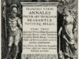
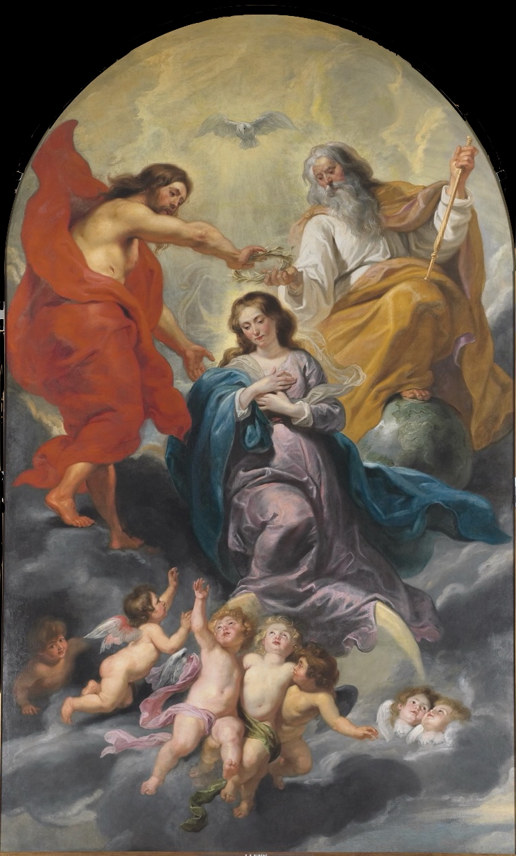
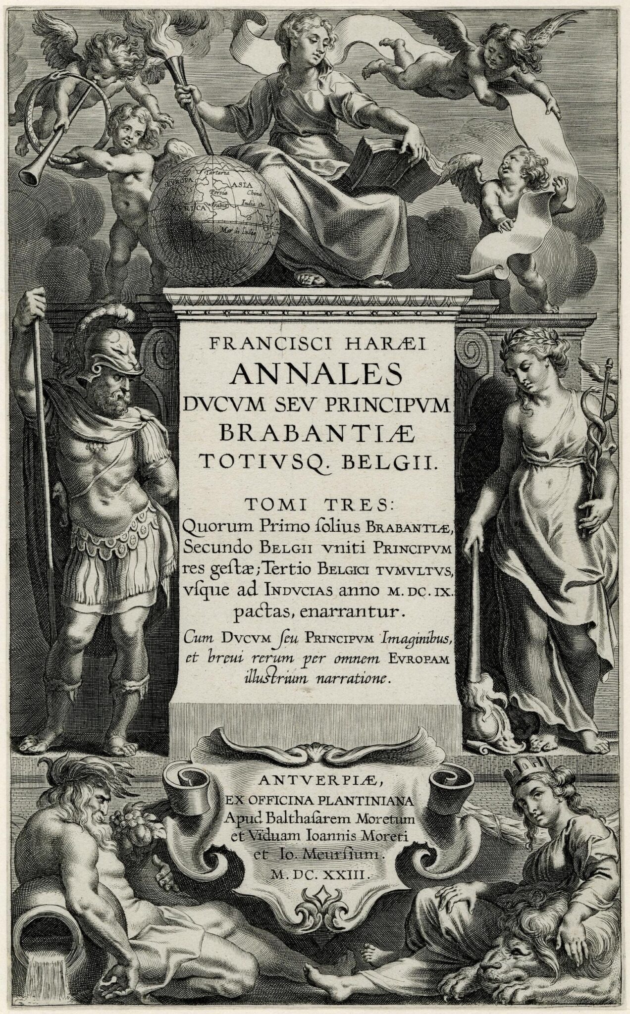
But there were some important commissions for which Rubens did carefully position the landmasses of the world. In his giant Coronation of the Virgin, completed for the Recollects Convent of Antwerp, Rubens used the globe as a throne for God the Father (fig. 34). Rotating it to visualize the Mediterranean, Rubens cleverly placed God’s foot on northern Europe, situating him metaphorically atop Antwerp itself.76 He did something similar for Antwerp’s Sint-Paulus-Kerk in a scene of Saints Francis and Dominic protecting the world from Christ’s wrath, visualized as thunderbolts ready to be hurled at the Earth. But the two founders of mendicant orders cover this orb, leaving Italy visible, as Adam Sammut has noted, to show the seat of worldly Christendom in Rome and, as Hans Vlieghe suggested, to offer special, metaphorical protection to Antwerp, which is tucked under the shelter of Dominic’s robes.77 We might also look to exceptional instances of Rubens’s deployment of the globe in designs for print: the title page of Franciscus Haraeus’s Annales ducum Brabantiae, in which a globe is rotated to show Europe, Africa, and Asia, all labeled (fig. 35);78 or the printer’s device for the Van Keerbergen press, featuring a carefully delineated pairing of Europe and Africa (fig. 36).79
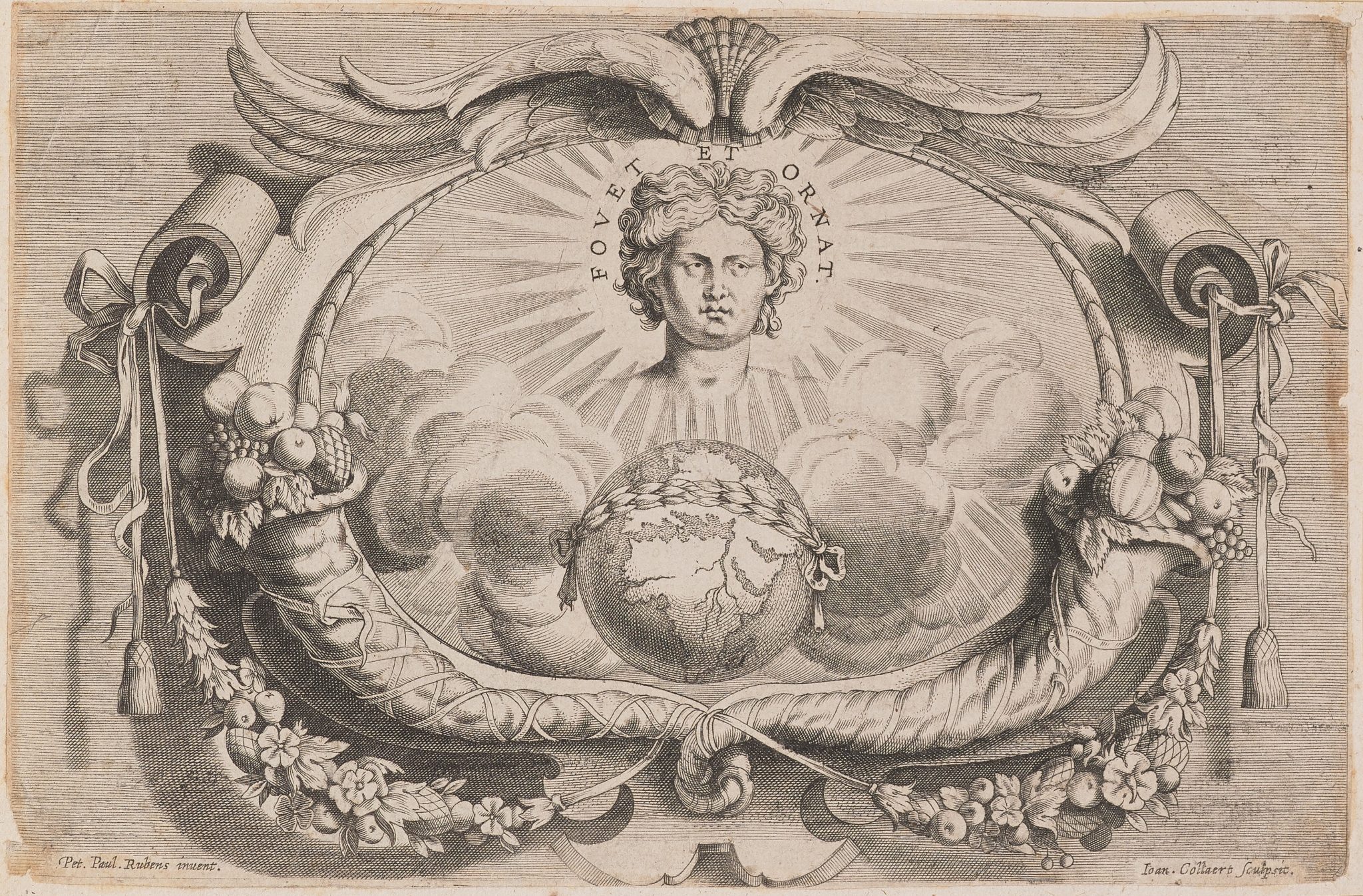
These are all useful counterexamples. But these globes share something important that helps to clarify what sort of attention Rubens paid to the subject when he set his sights on the world. Whether through abundant and carefully positioned drapery, or a dramatically darkened shadow, or the calibration of the globe’s rotation, Rubens reduced the broader, newly expanded world of his own time to just the three continents—the connected landmasses—that had been known to classical antiquity and for all of European history until 1492. Entirely absent in any of these views—as opposed to, for instance, the Floris and Francken pictures discussed above—is the suggestion or description of the vast expanses of territory in the Americas, Oceania, and parts of Asia that were separated from the classical world by the Atlantic and Pacific Oceans.80 Rubens clung to old edges—the borders of a known world defined by the shores of Europe at one extreme and Asia on the other.
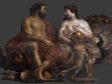
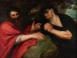
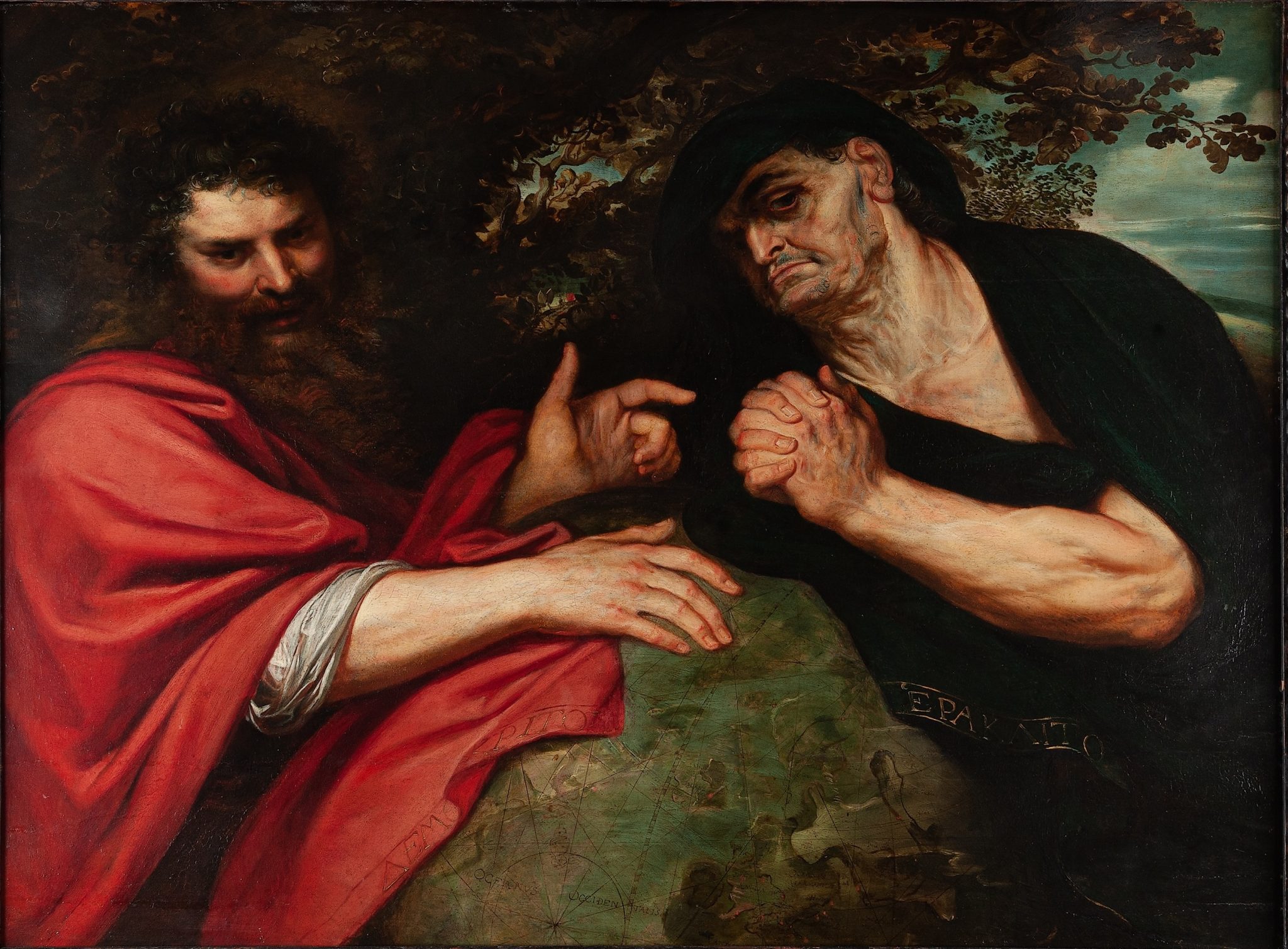
One could ascribe Rubens’s resistance to the newly expanded and more globally connected world of his own time to a deep commitment to classical sources. His handling of a globe in conjunction with an antique subject might thus help make the point. When Rubens traveled to Spain in 1603 for the Duke of Gonzaga (1587–1612), he produced two paintings for the Duke of Lerma (ca. 1552–1625), including Democritus and Heraclitus (fig. 37). Rubens, presumably modeling his youthful picture on Italian examples, literalized the two philosophers’ alternate responses to the state of the world—laughing and crying—with a large globe placed between them. The globe is notably contemporaneous with Rubens rather than these ancient men, a strange juxtaposition made clear by the shape, the compass rose and loxodromes, and the Latin script (contrasting with the Greek inscribed onto the hems of the philosophers’ robes).81 This was an odd choice. The rotation of the globe that brings into view the edge of Europe and the British Isles should also have shown the newly discovered Americas, unknown to these antique thinkers. To avoid this geographic anachronism, Rubens swathed Democritus’s rhetorically gesturing arms in extra folds of drapery in order to cloak this part of the world and hide these inconvenient continents. It would arguably have been easier to pick a different visualization of earthly geographies, a view of the globe that presented no mismatch between antique ideology and an early modern Catholic world in the first place. The choice to both include and deny this newly configured globe thus evinces a tension, perhaps even a struggle, within Rubens’s conceptualization of the world in which he lived. When Rubens returned to the theme some thirty years later for the Torre de la Parada (1636–38), he forewent the trouble, using a blue-green mixture and an undefined coastline across the globe that evade geographic specificity altogether.82
These may all seem like mere pictorial coincidences, if such things were to exist. But one can also look to Rubens’s unusually voluminous and wide-ranging correspondence, a mass of writing that survives from across his career, in which he makes mention of the Americas on precisely two occasions, and not in terms of events on these two recently “discovered” continents nor, like Albrecht Dürer, in praise of American antiquities and their artisanry.83 Instead, he mentions this part of the world only with respect to missing ships: the mechanisms of returning Spanish silver, lost at sea.84 A quick look at what is known of his expansive library shows a similar trend. We understand him to have owned a grand total of two volumes dedicated to the Americas, both outdated by the time he purchased them.85 Perusing an inventory of his broader collection, one does find Cluverius’s Introductio in Universam Geographiam (1624), a ranging geographic description of all the world’s countries. But Rubens only acquired the first of six volumes—the one treating, in almost purely philosophical terms, the nature of the world—meaning that he avoided the trouble and expense of purchasing the subsequent five, which actually describe the world with geographic and cultural particularity.86 In reading practice as much as pictorial habit, then, Rubens seems to have evaded the geographic and cultural reconfigurations going on around him.
As the discipline of art history took a turn toward the global, just about the worst thing that one could be called was “Eurocentric.” The accusation was aimed at scholarly accounts that appeared to cling to an old conception of the world by refusing to take into consideration a globalized perspective that had come more forcefully into view with the fall of the Berlin Wall in 1989 and the 1992 quincentennial reexaminations of Columbus’s voyage across the Atlantic. In the subsequent decades, a “Eurocentric” art history insisted on continuing to place particular weight on “strictly” European spaces with claims to origins in classical antiquity and allowed a consideration only of other “great” civilizations, largely confined to parts of Asia that were also beholden to imperial traditions.
But what happens when we encounter such tendencies in a historical actor? And was Rubens not one of them? Was the weight of his classical vision not just a bit retrograde? Would this same criticism not also impeach Rubens, who clearly—even as he acted as an important diplomat for Spain87—concerned himself with an earlier view of the world that knew only three continents? This should not actually surprise us. The geographic habits of art history that resisted a global turn were established by treating the careers and interests of precisely such figures of the historical past. While there are exceptions, and a global art history has exposed them with celebration, little has been done to recognize and, ultimately, to grapple with the fact that figures whose work pushes back against newer historiographic and methodological currents sit at the center of the discipline’s canon.
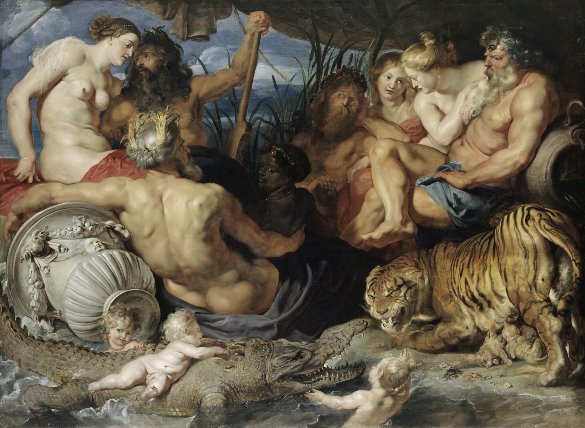
There is perhaps no case of this mismatch more exemplary than Rubens’s lavishly painted allegory of river gods and accompanying attendants at the Kunsthistorisches Museum in Vienna, a work known for most of the twentieth century as The Four Continents (fig. 38). Indeed, what else could possibly have been intended by four figures of varying complexions, with exoticizing attributes, at a time of such profound shifts in European expansion and colonialism? Yet Elizabeth McGrath has provided a surprising and forceful corrective. She offers a panoply of textual evidence from antique sources that we know Rubens to have owned and turned to routinely in order to demonstrate that the picture is meant to depict instead the “Four Rivers”—the Ganges, Euphrates, Tigris, and Nile88—that is, the four major rivers on the three continents known to the classical world. Here again, Rubens reduced the four known continents of his own time back to the three that were charted by classical antiquity.
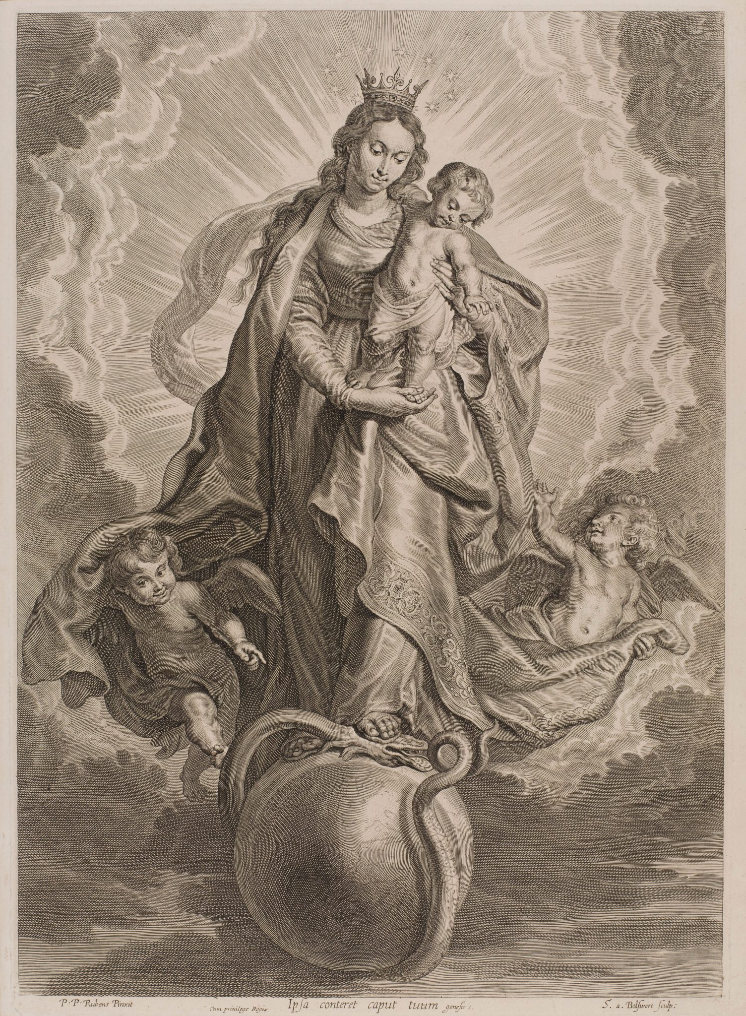
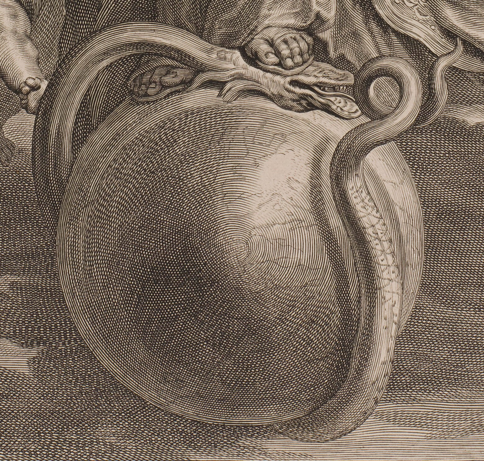
As the present essay has suggested, this was not a one-off way of seeing, reframing, and reducing the expanded world of his own moment. A final example gives form to Rubens’s consistently limited sense of the world’s geography from within a cultural context that generally had a much more expansive view. Rubens painted an unusual iconography—a mixture of the Virgin and Child and the Apocalyptic woman (not normally shown with a child) treading on the globe—for the Brussels church of Notre-Dame du Finistère.89 The damaged, later dismantled, picture is best known through its reproduction, as engravers in Rubens’s immediate purview set about memorializing the composition in print (fig. 39). At this point, someone decided to give the orb definitive geographic specificity, to trace the contours of the world; and the maneuvers were similar to ones we have seen (fig. 40). A snake moves to bite its tail and the Virgin steps upon it, directly above Antwerp and the Southern Netherlands. We see the Mediterranean, and Africa’s outline is clearly in view. Land extends to the East, onward—we understand—to Asia. This particular rotation of the globe should in theory have also offered the viewer the Americas on the left-hand side. Given the nature of printed production, it is hard to know exactly why it does not—to know exactly how the pictorial choices that define the left-side of the sphere were made and by whom. But this partial globe with continents erased, subsumed within or canceled below a dense network of moirés and arcing lines, is emblematic of Rubens—of a global inattentiveness that scumbled the surfaces of the world.